Approximate Location Map
Large Map »
Latitude: 56.7095 / 56°42'34"N
Longitude: -2.9634 / 2°57'48"W
OS Eastings: 341120
OS Northings: 757953
OS Grid: NO411579
Mapcode National: GBR VK.5CMN
Mapcode Global: WH7Q5.GM37
Plus Code: 9C8VP25P+RM
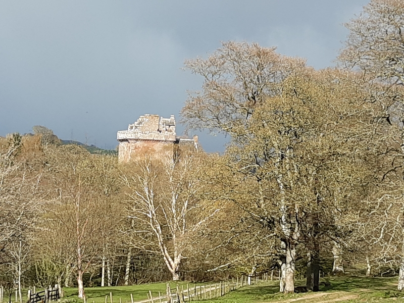
Entry Name: Inverquharity Castle
Listing Name: Inverquharity Castle
Listing Date: 11 June 1971
Category: A
Source: Historic Scotland
Source ID: 344258
Historic Scotland Designation Reference: LB11665
Building Class: Cultural
ID on this website: 200344258
Location: Kirriemuir
County: Angus
Electoral Ward: Kirriemuir and Dean
Parish: Kirriemuir
Traditional County: Angus
Tagged with: Castle
Four-storey, (formerly L-plan), tower-house, ashlar, with two vaulted floors, corbelled battlements with angle bartizans and machicolations, and gabled caphouse. Re-entrant entrance door has pointed arch and contains iron yett. 15th cent.
Ministry of Works. Scheduled.
External links are from the relevant listing authority and, where applicable, Wikidata. Wikidata IDs may be related buildings as well as this specific building. If you want to add or update a link, you will need to do so by editing the Wikidata entry.


Other nearby listed buildings
