Approximate Location Map
Large Map »
Latitude: 56.0617 / 56°3'42"N
Longitude: -3.8487 / 3°50'55"W
OS Eastings: 284984
OS Northings: 686967
OS Grid: NS849869
Mapcode National: GBR 1G.Q5BD
Mapcode Global: WH4PF.VWGX
Plus Code: 9C8R3562+MG
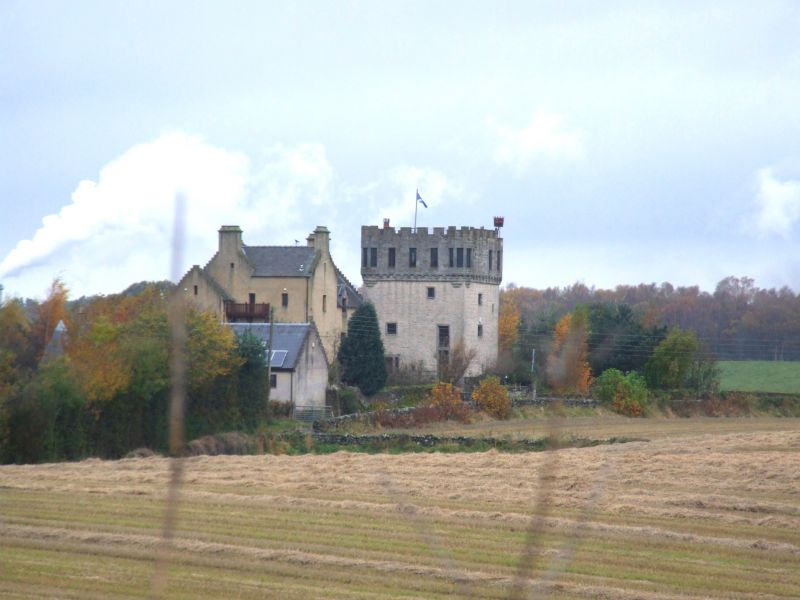
Entry Name: Plean Tower
Listing Name: Plean Tower
Listing Date: 5 September 1973
Category: B
Source: Historic Scotland
Source ID: 347080
Historic Scotland Designation Reference: LB13859
Building Class: Cultural
Also known as: Cock-a-bendy Castle
Mengie Castle
Menzies Castle
Plane Castle
ID on this website: 200347080
Location: St Ninians
County: Stirling
Electoral Ward: Bannockburn
Parish: St Ninians
Traditional County: Stirlingshire
Tagged with: Castle Tower house
Mengies Castle. 16th Century castle with 19th century folly dditions. Remains of early kitchen adjoin with barred vaults.
Loose rubble inside. Spiral stair has collapsed.
External links are from the relevant listing authority and, where applicable, Wikidata. Wikidata IDs may be related buildings as well as this specific building. If you want to add or update a link, you will need to do so by editing the Wikidata entry.


Other nearby listed buildings
