Approximate Location Map
Large Map »
Latitude: 55.5768 / 55°34'36"N
Longitude: -4.5973 / 4°35'50"W
OS Eastings: 236360
OS Northings: 634517
OS Grid: NS363345
Mapcode National: GBR 3B.PRZB
Mapcode Global: WH3QG.C313
Plus Code: 9C7QHCG3+P3
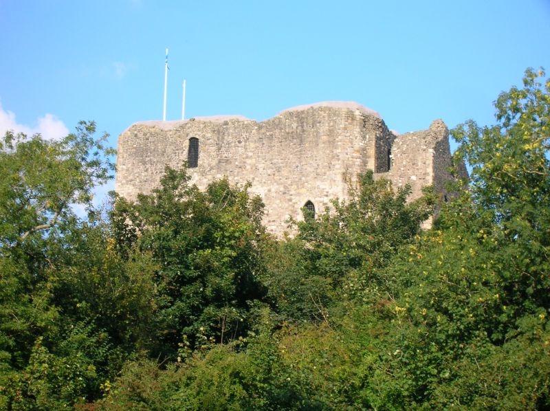
Entry Name: Dundonald Castle
Listing Date: 14 April 1971
Category: A
Source: Historic Scotland
Source ID: 331441
Historic Scotland Designation Reference: LB983
Building Class: Cultural
ID on this website: 200331441
Location: Dundonald
County: South Ayrshire
Electoral Ward: Kyle
Parish: Dundonald
Traditional County: Ayrshire
Tagged with: Castle Contour fort Level terrain fort
King Robert II rebuilt this castle which became his
favourite residence. His chief work at Dundonald consists
of a very large oblong tower-house, remarkable in itself
and for the way in which it incorporates the remains of a
13th century gatehouse - Most of this tower, and much of
the barmkin well survive - The castle stands on an
isolated hill and is a notable landmark.
Guardianship Monument
External links are from the relevant listing authority and, where applicable, Wikidata. Wikidata IDs may be related buildings as well as this specific building. If you want to add or update a link, you will need to do so by editing the Wikidata entry.


Other nearby listed buildings
