Approximate Location Map
Large Map »
Latitude: 51.8749 / 51°52'29"N
Longitude: -3.233 / 3°13'58"W
OS Eastings: 315215
OS Northings: 220306
OS Grid: SO152203
Mapcode National: GBR YW.S4P6
Mapcode Global: VH6CF.X46K
Plus Code: 9C3RVQF8+WR
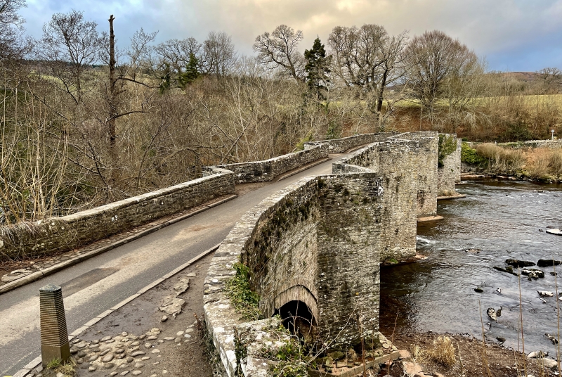
Entry Name: Llangynidr Bridge (partly in Llangynidr community)
Listing Date: 21 October 1998
Last Amended: 21 October 1998
Grade: I
Source: Cadw
Source ID: 20677
Building Class: Transport
ID on this website: 300020677
Location: Spanning the River Usk on the B4560.
County: Powys
Community: Llanfihangel Cwmdu with Bwlch and Cathedine (Llanfihangel Cwm Du gyda Bwlch a Chathedin)
Community: Llanfihangel Cwmdu with Bwlch and Cathedine
Built-Up Area: Llangynidr
Traditional County: Brecknockshire
Tagged with: Road bridge
External links are from the relevant listing authority and, where applicable, Wikidata. Wikidata IDs may be related buildings as well as this specific building. If you want to add or update a link, you will need to do so by editing the Wikidata entry.


Other nearby listed buildings
