Approximate Location Map
Large Map »
Latitude: 53.1386 / 53°8'18"N
Longitude: -3.6817 / 3°40'53"W
OS Eastings: 287602
OS Northings: 361479
OS Grid: SH876614
Mapcode National: GBR 69.664W
Mapcode Global: WH65Z.FC1R
Plus Code: 9C5R48Q9+C8
Entry Name: Telephone Call-box
Listing Date: 28 August 1990
Last Amended: 17 March 1999
Grade: II
Source: Cadw
Source ID: 274
Building Class: Communications
ID on this website: 300000274
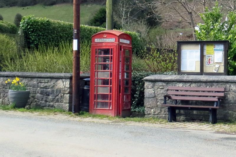
Location: The telephone call box is located beside the car park of the Lion Inn S of Gwytherin village centre, on the W side of the minor road leading S out of the village, set into recess in stone boundary wal
County: Conwy
Town: Abergele
Community: Llangernyw
Community: Llangernyw
Locality: Gwytherin
Traditional County: Denbighshire
Tagged with: Red telephone box
Standard design of Giles Gilbert Scott, architect, introduced by GPO in 1936. This example dates from the reign of King George VI.
Telephone call box, K6 type square, red kiosk of cast-iron construction. Domed roof with four lunettes containing embossed crowns over red lettered opals (2 removed) and ventilation slits. Raised surrounds to sides and door with marginal bars to horizontal glazing. Blank rear, moulded plinth. Foundry plate inscribed: ''Macfarlane & Co Ltd, Saracen Foundry, Glasgow''.
Included because of prominent location on southern outskirts of attractive old village.
External links are from the relevant listing authority and, where applicable, Wikidata. Wikidata IDs may be related buildings as well as this specific building. If you want to add or update a link, you will need to do so by editing the Wikidata entry.


Other nearby listed buildings
