Approximate Location Map
Large Map »
Latitude: 53.3221 / 53°19'19"N
Longitude: -3.8286 / 3°49'43"W
OS Eastings: 278293
OS Northings: 382137
OS Grid: SH782821
Mapcode National: GBR 1ZP0.XT
Mapcode Global: WH64Y.5R3K
Plus Code: 9C5R85CC+VG
Entry Name: Drinking Trough
Listing Date: 16 March 1976
Last Amended: 6 June 2001
Grade: II
Source: Cadw
Source ID: 3374
Building Class: Gardens, Parks and Urban Spaces
ID on this website: 300003374
Location: On island in road at junction with Trinity Square and Madoc Street.
County: Conwy
Community: Llandudno
Community: Llandudno
Built-Up Area: Llandudno
Traditional County: Caernarfonshire
Tagged with: Architectural structure
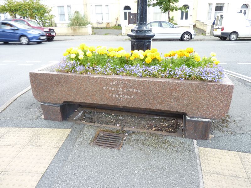
Dated 1894.
Trough of granite with rectangular sides rounded at the corners and the base, and supported by a short rectangular pier at each end. Front wall of the trough bears the following inscription: 'Presented/by/Mrs William Jenkins/of Birmingham/1894'.
Rare C19 horse trough. Group value with adjacent lampstandard.
External links are from the relevant listing authority and, where applicable, Wikidata. Wikidata IDs may be related buildings as well as this specific building. If you want to add or update a link, you will need to do so by editing the Wikidata entry.


Other nearby listed buildings
