Approximate Location Map
Large Map »
Latitude: 53.2638 / 53°15'49"N
Longitude: -4.0941 / 4°5'38"W
OS Eastings: 260421
OS Northings: 376139
OS Grid: SH604761
Mapcode National: GBR JN82.7BX
Mapcode Global: WH542.27P6
Plus Code: 9C5Q7W74+G8
Entry Name: Table tomb in Beaumaris churchyard
Listing Date: 13 July 2005
Last Amended: 13 July 2005
Grade: II
Source: Cadw
Source ID: 84794
ID on this website: 300084794
Location: On the S side of the chancel.
County: Isle of Anglesey
Town: Beaumaris
Community: Beaumaris (Biwmares)
Community: Beaumaris
Built-Up Area: Beaumaris
Traditional County: Anglesey
Tagged with: Tomb
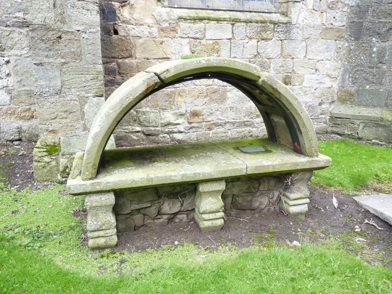
An C18 table tomb with moulded legs, slab with weathered memorial inscription and an exceptional stone, arched canopy. The upper, original part, of the inscription is no longer legible. A lower inscription is dated 1735 and a small added brass plaque commemorates Hugh Jones (d 1776).
Listed for its special historic interest as a very rare and well-preserved C18 graveyard memorial, and for its contribution to the setting of the church.
External links are from the relevant listing authority and, where applicable, Wikidata. Wikidata IDs may be related buildings as well as this specific building. If you want to add or update a link, you will need to do so by editing the Wikidata entry.


Other nearby listed buildings
