Approximate Location Map
Large Map »
Latitude: 53.1809 / 53°10'51"N
Longitude: -3.4193 / 3°25'9"W
OS Eastings: 305243
OS Northings: 365805
OS Grid: SJ052658
Mapcode National: GBR 6M.3PWL
Mapcode Global: WH771.F9ZT
Plus Code: 9C5R5HJJ+97
Entry Name: Town Wall, including North-East, Countess and Goblin Towers
Listing Date: 24 October 1950
Last Amended: 27 February 2004
Grade: I
Source: Cadw
Source ID: 954
Building Class: Defence
ID on this website: 300000954
Location: Defining the Old Town boundary in a long arc to the E of the castle and rising dramatically at the top of a wooded, craggy hill-slope.
County: Denbighshire
Community: Denbigh (Dinbych)
Community: Denbigh
Locality: Denbigh - Castle
Built-Up Area: Denbigh
Traditional County: Denbighshire
Tagged with: City walls
Construction of the new castle and town wall circuit was begun in 1282 by the newly created Lord of Denbigh, Henry de Lacy, Earl of Lincoln. Of the town walls, the main stretch, including the surviving North-eastern and Countess' towers, was probably complete by c1290. In around 1295 a further stretch was created which projected eastwards in an arc beyond the line of the original wall across a steep rock face. This salient was constructed to embrace a spring or well which lay outside the boundary of the town proper. The main castle well tended to dry up during hot summers, so the necessity of encompassing this secondary source within the defensive circuit is clear. The focus of this projection was the mighty Goblin Tower, a vast polygonal tower built over the spring on rock foundations.
During the Civil War the castle and old town were garrisoned and defended for the king by Colonel William Salesbury, a redoubtable commander known as 'Old blue stockings'. The famous siege of Denbigh under the parliamentarian generals Middleton and Mytton lasted for some nine months, during which time 'brave Denbigh' valiantly held out to much royalist acclaim (a contemporary poem describes the 'palace of Dame Loyalltie...surrounded closely with a narrow sea of black rebellion'). During the siege various attempts were made to storm and seize the Goblin Tower which, with the associated sections of town wall, still show the considerable damage caused by Mytton's heavy siege guns. Close to the base of the Goblin Tower, now in the grounds of Howell's School, is a crescent-shaped earthwork. This was erected by the defenders to protect the tower's base from artillery damage; in the C19 many canon balls were recovered from this area.
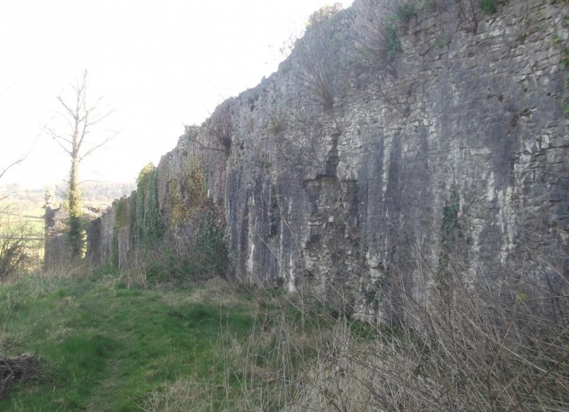
Town walls of uncoursed, flush-faced limestone rubble, mostly on rock foundations and with buff-brown sandstone quoining. Most of the enceinte is traceable and the segment from North-east to South is particularly good, despite heavy Civil War artillery damage. This latter section includes the half-round North-east and Bastion towers, the rectangular Countess' Tower and the polygonal Goblin Tower. The walls vary in height up to a maximum of 5m; the crenellations are lost. The Goblin Tower is some 15m high and has a heavily-battered plinth rising to approximately 5m on the N side. There are irregular openings to each face (former slit-lights with wide inward splays), all of which have been widened through blasting; squinching where the walls meet the tower.
On the West side of the old town is a section which includes the site of the Exchequer Gate. (See record number 82445).
Listed Grade I as a highly-important surviving stretch of late C13/early C14 town wall, including the notable Goblin Tower.
Scheduled Ancient Monument (AM 2 RCAM 122).
External links are from the relevant listing authority and, where applicable, Wikidata. Wikidata IDs may be related buildings as well as this specific building. If you want to add or update a link, you will need to do so by editing the Wikidata entry.


Other nearby listed buildings
