Approximate Location Map
Large Map »
Latitude: 51.3273 / 51°19'38"N
Longitude: -2.1938 / 2°11'37"W
OS Eastings: 386589
OS Northings: 158708
OS Grid: ST865587
Mapcode National: GBR 1SM.Q55
Mapcode Global: VH96W.XWKV
Plus Code: 9C3V8RG4+WF
Entry Name: Garden Wall of Rodwell Hall to Victoria Road
Listing Date: 26 November 1976
Grade: II
Source: Historic England
Source ID: 1021671
English Heritage Legacy ID: 314182
ID on this website: 101021671
Location: Hilperton, Wiltshire, BA14
County: Wiltshire
Civil Parish: Trowbridge
Built-Up Area: Trowbridge
Traditional County: Wiltshire
Lieutenancy Area (Ceremonial County): Wiltshire
Church of England Parish: Trowbridge St James
Church of England Diocese: Salisbury
Tagged with: Wall
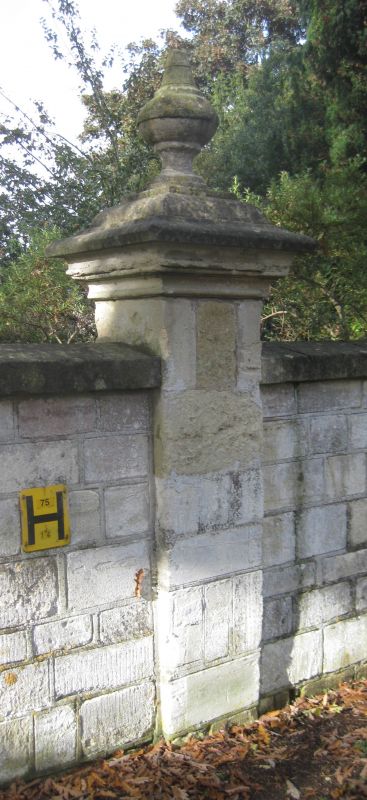
VICTORIA ROAD
1.
5411
(South Side)
Garden wall of Rodwell Hall
to Victoria Road
ST 8658 10/393B
II
2.
Mid C19. 3 to 4 ft high. Rough ashlar. Part crenellated in returned to east.
Listing NGR: ST8658958708
External links are from the relevant listing authority and, where applicable, Wikidata. Wikidata IDs may be related buildings as well as this specific building. If you want to add or update a link, you will need to do so by editing the Wikidata entry.


Other nearby listed buildings
