Approximate Location Map
Large Map »
Latitude: 51.6424 / 51°38'32"N
Longitude: -1.8552 / 1°51'18"W
OS Eastings: 410114
OS Northings: 193746
OS Grid: SU101937
Mapcode National: GBR 3RV.ZR2
Mapcode Global: VHB2Z.SZL9
Plus Code: 9C3WJ4RV+XW
Entry Name: 90, High Street
Listing Date: 25 August 1976
Grade: II
Source: Historic England
Source ID: 1023118
English Heritage Legacy ID: 317823
ID on this website: 101023118
Location: Cricklade, Wiltshire, SN6
County: Wiltshire
Civil Parish: Cricklade
Built-Up Area: Cricklade
Traditional County: Wiltshire
Lieutenancy Area (Ceremonial County): Wiltshire
Church of England Parish: Cricklade
Church of England Diocese: Bristol
Tagged with: Building
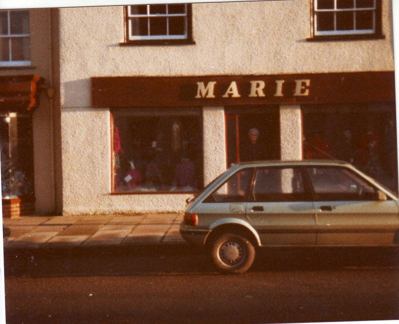
SU 19 SW CRICKLADE HIGH STREET
(east side)
13/173 No. 90
25.8.76
GV II
Shop in row. Late C18, altered. Rendered, with stone slate roof.
Two storeys, and attic, 2 bays. Ground floor plate glass shop
windows with central entrance. Six-pane single hung sashes to
first floor. Central gabled dormer. Included for group value.
Listing NGR: SU1011693745
External links are from the relevant listing authority and, where applicable, Wikidata. Wikidata IDs may be related buildings as well as this specific building. If you want to add or update a link, you will need to do so by editing the Wikidata entry.


Other nearby listed buildings
