Approximate Location Map
Large Map »
Latitude: 51.6278 / 51°37'40"N
Longitude: -1.73 / 1°43'48"W
OS Eastings: 418785
OS Northings: 192145
OS Grid: SU187921
Mapcode National: GBR 4TK.TP9
Mapcode Global: VHB37.YBSZ
Plus Code: 9C3WJ7H9+4X
Entry Name: Barn to South of No 12
Listing Date: 26 January 1955
Grade: II
Source: Historic England
Source ID: 1023348
English Heritage Legacy ID: 318384
ID on this website: 101023348
Location: Swindon, Wiltshire, SN6
County: Swindon
Civil Parish: Highworth
Traditional County: Wiltshire
Lieutenancy Area (Ceremonial County): Wiltshire
Church of England Parish: Highworth with Sevenhampton and Inglesham
Church of England Diocese: Bristol
Tagged with: Barn
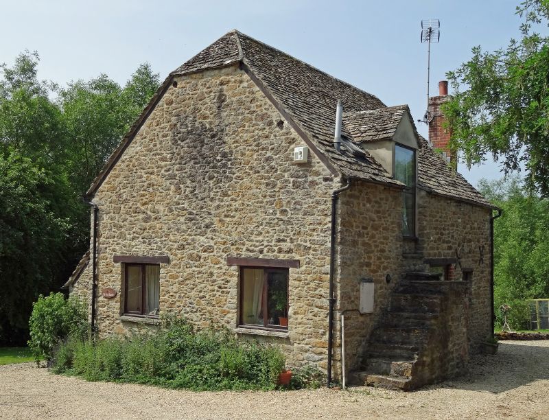
1.
5410 HIGHWORTH HAMPTON
Barn to south of No 12
SU 19 SE 5/265 26.1.55
II
2.
Small C18 rubble barn. Half hipped stone slate roof. Steps up to gabled
doorway to left of centre. Stable door and window below. Interior: 3 bays,
trusses have king-posts from collars supported by strum at lower purlin level.
Listing NGR: SU1878592145
External links are from the relevant listing authority and, where applicable, Wikidata. Wikidata IDs may be related buildings as well as this specific building. If you want to add or update a link, you will need to do so by editing the Wikidata entry.


Other nearby listed buildings
