Approximate Location Map
Large Map »
Latitude: 51.6315 / 51°37'53"N
Longitude: -1.7109 / 1°42'39"W
OS Eastings: 420105
OS Northings: 192565
OS Grid: SU201925
Mapcode National: GBR 4TL.L83
Mapcode Global: VHC0Q.98C3
Plus Code: 9C3WJ7JQ+JJ
Entry Name: Wall to Vicarage Facing Vicarage Lane
Listing Date: 20 September 1979
Grade: II
Source: Historic England
Source ID: 1023385
English Heritage Legacy ID: 318480
ID on this website: 101023385
Location: Highworth, Swindon, Wiltshire, SN6
County: Swindon
Civil Parish: Highworth
Built-Up Area: Highworth
Traditional County: Wiltshire
Lieutenancy Area (Ceremonial County): Wiltshire
Church of England Parish: Highworth with Sevenhampton and Inglesham
Church of England Diocese: Bristol
Tagged with: Wall
1.
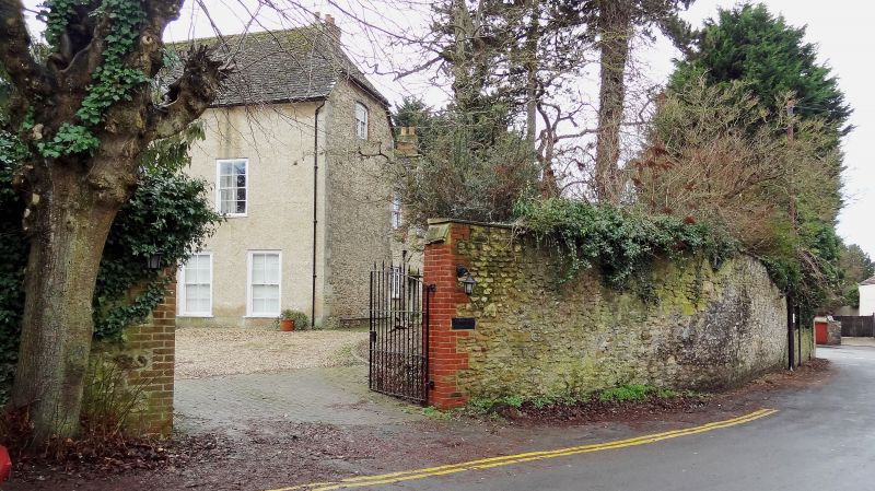
5410 HIGHWORTH VICARAGE LANE
Wall to Vicarage
facing Vicarage Lane
SU 2092 NW 18/351
II GV
2.
Probably early C19. Only that section facing Vicarage Lane. About 90 yds.
About 7-8 ft rubble, slightly curved to coach house (qv Church House) entrance.
Stepped down towards Lechlade Road.
Listing NGR: SU2010692565
External links are from the relevant listing authority and, where applicable, Wikidata. Wikidata IDs may be related buildings as well as this specific building. If you want to add or update a link, you will need to do so by editing the Wikidata entry.


Other nearby listed buildings
