Approximate Location Map
Large Map »
Latitude: 50.9406 / 50°56'26"N
Longitude: -0.4925 / 0°29'32"W
OS Eastings: 506014
OS Northings: 116771
OS Grid: TQ060167
Mapcode National: GBR GJG.VQX
Mapcode Global: FRA 96VM.9ZL
Plus Code: 9C2XWGR5+72
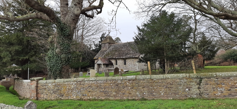
Entry Name: Wiggonholt Church
Listing Date: 15 March 1955
Grade: I
Source: Historic England
Source ID: 1027364
English Heritage Legacy ID: 298510
ID on this website: 101027364
Location: Wiggonholt, Horsham, West Sussex, RH20
County: West Sussex
District: Horsham
Civil Parish: Parham
Traditional County: Sussex
Lieutenancy Area (Ceremonial County): West Sussex
Church of England Parish: Wiggonholt
Church of England Diocese: Chichester
Tagged with: Church building
PARHAM WIGGONHOLT
1.
5404
Wiggonholt Church
TQ 01 NE 6/586 15.3.55
I
2.
C13. Chancel and nave without division, western shingled bell-turret and south
porch.
Listing NGR: TQ0601616771
External links are from the relevant listing authority and, where applicable, Wikidata. Wikidata IDs may be related buildings as well as this specific building. If you want to add or update a link, you will need to do so by editing the Wikidata entry.


Other nearby listed buildings
