Approximate Location Map
Large Map »
Latitude: 50.9095 / 50°54'34"N
Longitude: -0.5336 / 0°32'1"W
OS Eastings: 503190
OS Northings: 113254
OS Grid: TQ031132
Mapcode National: GBR GJS.XKG
Mapcode Global: FRA 96RP.ZW7
Plus Code: 9C2XWF58+RG
Entry Name: The White House
Listing Date: 15 March 1955
Grade: II
Source: Historic England
Source ID: 1027471
English Heritage Legacy ID: 298246
ID on this website: 101027471
Location: Cross Gate, Horsham, West Sussex, BN18
County: West Sussex
District: Horsham
Civil Parish: Amberley
Built-Up Area: Amberley
Traditional County: Sussex
Lieutenancy Area (Ceremonial County): West Sussex
Church of England Parish: Amberley with North Stoke
Church of England Diocese: Chichester
Tagged with: House
AMBERLEY EAST STREET
1.
5404
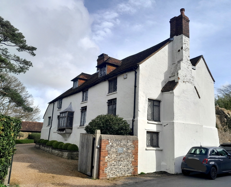
The White House
TQ 0313 21/648 15.3.55
II
2.
C17 or earlier, restored. Two storeys and attic, with semi-basement at south
end owing to the slope of the ground. Four windows. Two hipped dormers.
Plastered front. Tiled roof. Modern casement windows. Doorway up nine steps
with tent-shaped canopy over. Chimney breast at south end.
Listing NGR: TQ0319013254
External links are from the relevant listing authority and, where applicable, Wikidata. Wikidata IDs may be related buildings as well as this specific building. If you want to add or update a link, you will need to do so by editing the Wikidata entry.


Other nearby listed buildings
