Approximate Location Map
Large Map »
Latitude: 50.7821 / 50°46'55"N
Longitude: -0.7357 / 0°44'8"W
OS Eastings: 489230
OS Northings: 98825
OS Grid: SZ892988
Mapcode National: GBR DHF.SZ8
Mapcode Global: FRA 97B0.Z2Q
Plus Code: 9C2XQ7J7+VP
Entry Name: Nyetimber Windmill
Listing Date: 15 January 1975
Grade: II
Source: Historic England
Source ID: 1027577
English Heritage Legacy ID: 297997
ID on this website: 101027577
Location: Nyetimber, Arun, West Sussex, PO21
County: West Sussex
District: Arun
Civil Parish: Pagham
Built-Up Area: Bognor Regis
Traditional County: Sussex
Lieutenancy Area (Ceremonial County): West Sussex
Church of England Parish: Pagham St Thomas a Becket
Church of England Diocese: Chichester
Tagged with: Tower mill
SZ 89 NE PAGHAM PAGHAM ROAD
20/502 NYETIMBER
(west side)
15.1.75
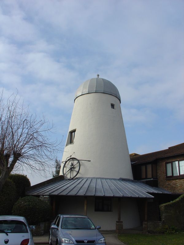
Nyetimber Windmill
II
Built about 1840. Tower mill, built of brick, tarred, but now entirely engulfed in
ivy. Cap, sweeps and fantail all missing.
Listing NGR: SZ8923098825
External links are from the relevant listing authority and, where applicable, Wikidata. Wikidata IDs may be related buildings as well as this specific building. If you want to add or update a link, you will need to do so by editing the Wikidata entry.


Other nearby listed buildings
