Approximate Location Map
Large Map »
Latitude: 52.7714 / 52°46'17"N
Longitude: -2.5428 / 2°32'34"W
OS Eastings: 363477
OS Northings: 319451
OS Grid: SJ634194
Mapcode National: GBR 7S.YDVR
Mapcode Global: WH9CN.XLBQ
Plus Code: 9C4VQFC4+HV
Entry Name: Fir Tree
Listing Date: 8 April 1983
Grade: II
Source: Historic England
Source ID: 1033312
English Heritage Legacy ID: 362408
ID on this website: 101033312
Location: Waters Upton, Telford and Wrekin, Shropshire, TF6
County: Telford and Wrekin
Civil Parish: Waters Upton
Traditional County: Shropshire
Lieutenancy Area (Ceremonial County): Shropshire
Church of England Parish: Waters Upton St Michael
Church of England Diocese: Lichfield
Tagged with: Building
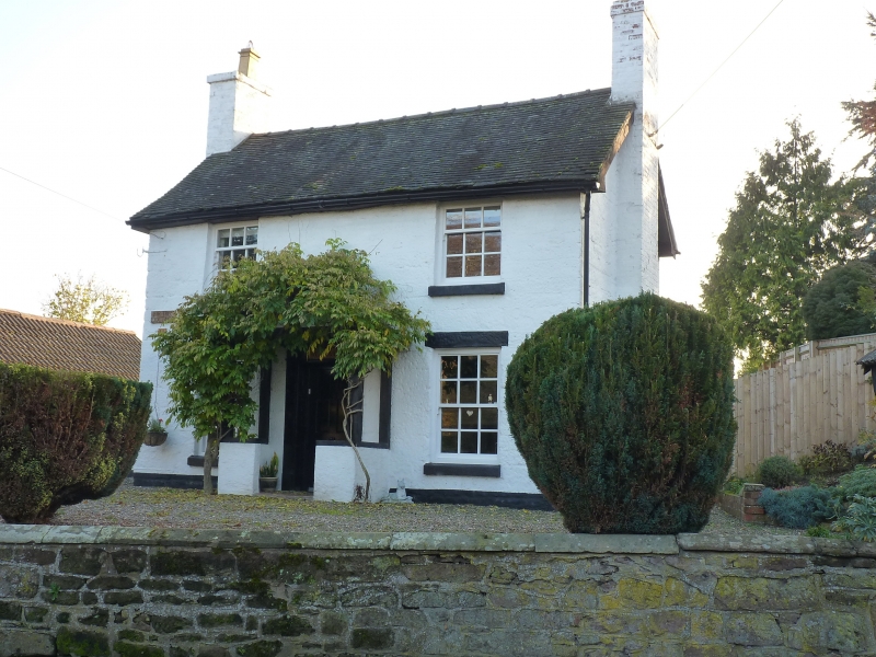
WATERS UPTON Fir Tree
1.
5362
SJ 6319 2/556
II GV
2.
Small early C19 painted sandstone ashlar house. Tiled roof with gabled ends.
Two-storeys. Two window range. Sashes with glazing bars. Central pilastered
doorcase with entablature with deep cornice, panelled reveals and panelled door.
Brick end stacks.
Listing NGR: SJ6347719451
External links are from the relevant listing authority and, where applicable, Wikidata. Wikidata IDs may be related buildings as well as this specific building. If you want to add or update a link, you will need to do so by editing the Wikidata entry.


Other nearby listed buildings
