Approximate Location Map
Large Map »
Latitude: 52.7356 / 52°44'8"N
Longitude: -2.3454 / 2°20'43"W
OS Eastings: 376776
OS Northings: 315390
OS Grid: SJ767153
Mapcode National: GBR 062.FVV
Mapcode Global: WH9CY.YHBM
Plus Code: 9C4VPMP3+7V
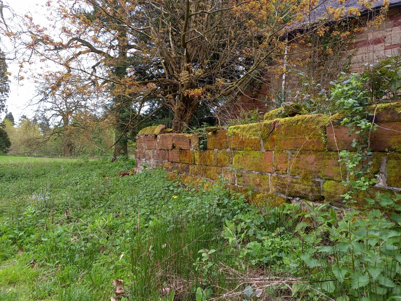
Entry Name: Churchyard Boundary Wall
Listing Date: 23 January 1981
Grade: II
Source: Historic England
Source ID: 1033340
English Heritage Legacy ID: 362475
ID on this website: 101033340
Location: St Peter's Church, Woodcote, Telford and Wrekin, Shropshire, TF10
County: Telford and Wrekin
Civil Parish: Chetwynd Aston and Woodcote
Traditional County: Shropshire
Lieutenancy Area (Ceremonial County): Shropshire
Church of England Parish: Church Aston St Andrew
Church of England Diocese: Lichfield
Tagged with: Building
WOODCOTE WOODCOTE
1.
5362 Churchyard boundary wall
SJ 71NE 25/619 23.1.81
II GV
2.
Probably C18 or C17. Low sandstone wall surrounding churchyard, with saddleback
coping.
Listing NGR: SJ7677615390
External links are from the relevant listing authority and, where applicable, Wikidata. Wikidata IDs may be related buildings as well as this specific building. If you want to add or update a link, you will need to do so by editing the Wikidata entry.


Other nearby listed buildings
