Approximate Location Map
Large Map »
Latitude: 51.4219 / 51°25'18"N
Longitude: -1.7284 / 1°43'42"W
OS Eastings: 418983
OS Northings: 169245
OS Grid: SU189692
Mapcode National: GBR 4X2.V58
Mapcode Global: VHC1P.0J4B
Plus Code: 9C3WC7CC+QM
Entry Name: 23 and 24, the Green
Listing Date: 21 October 1974
Grade: II
Source: Historic England
Source ID: 1034236
English Heritage Legacy ID: 310303
ID on this website: 101034236
Location: Marlborough, Wiltshire, SN8
County: Wiltshire
Civil Parish: Marlborough
Built-Up Area: Marlborough
Traditional County: Wiltshire
Lieutenancy Area (Ceremonial County): Wiltshire
Tagged with: Building
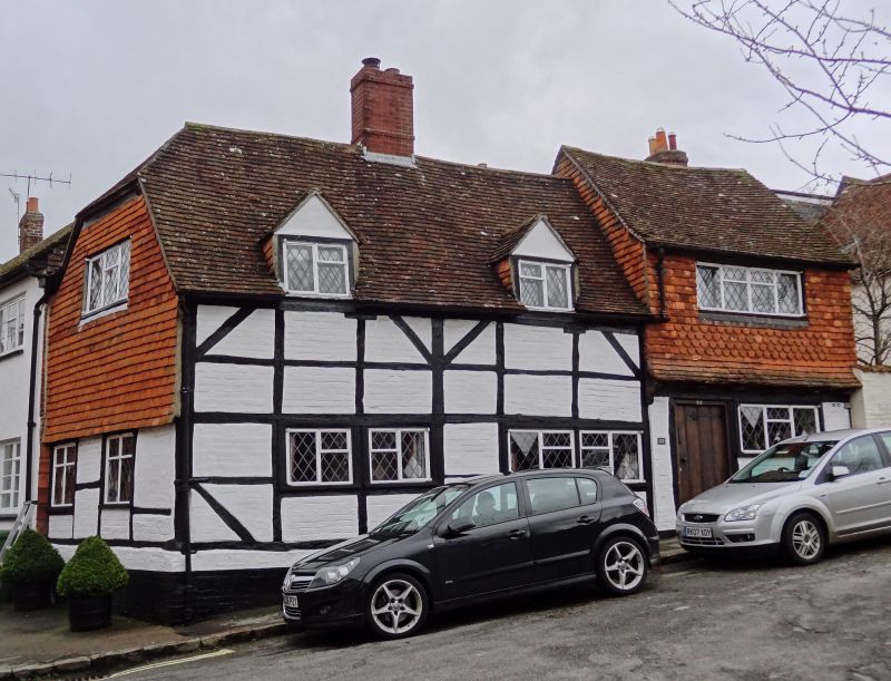
THE GREEN
i+
5407
(West Side)
Nos 23 and 24
SU 1869 1/79
II GV
2.
Cl6-17. 2 storey. Timber frame with brick infilling. Old tile roof. Irregular
casement windows, some Cl7 leaded and some Cl9 and plain doors. Right hand half
of lst floor tile-hung.
Nos l9 to 32 (consec) form a group.
Listing NGR: SU1898169244
External links are from the relevant listing authority and, where applicable, Wikidata. Wikidata IDs may be related buildings as well as this specific building. If you want to add or update a link, you will need to do so by editing the Wikidata entry.


Other nearby listed buildings
