Approximate Location Map
Large Map »
Latitude: 52.2815 / 52°16'53"N
Longitude: -1.5902 / 1°35'24"W
OS Eastings: 428050
OS Northings: 264895
OS Grid: SP280648
Mapcode National: GBR 5M4.SY9
Mapcode Global: VHBXH.DX5D
Plus Code: 9C4W7CJ5+HW
Entry Name: 64 66, Market Place
Listing Date: 19 March 1973
Grade: II
Source: Historic England
Source ID: 1035420
English Heritage Legacy ID: 307554
ID on this website: 101035420
Location: Warwick, Warwickshire, CV34
County: Warwickshire
District: Warwick
Civil Parish: Warwick
Built-Up Area: Warwick
Traditional County: Warwickshire
Lieutenancy Area (Ceremonial County): Warwickshire
Church of England Parish: Warwick St Mary
Church of England Diocese: Coventry
Tagged with: Building
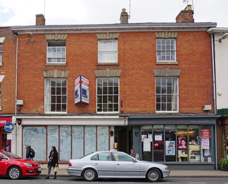
1.
1781 MARKET PLACE
(South Side)
Nos 64 and 66
SP 2864 NW 1/136
II
2.
Early C19 3 storey 3 window red brick facade. Sashes in cased frames with
flat, rusticated arches and keyblocks of local stone. Slender bracketed
wood cornice. Mid-Late C19 plate glass shopfront, with colonnettes beneath
entablature.
Listing NGR: SP2805064895
External links are from the relevant listing authority and, where applicable, Wikidata. Wikidata IDs may be related buildings as well as this specific building. If you want to add or update a link, you will need to do so by editing the Wikidata entry.


Other nearby listed buildings
