Approximate Location Map
Large Map »
Latitude: 51.2054 / 51°12'19"N
Longitude: -2.1863 / 2°11'10"W
OS Eastings: 387082
OS Northings: 145147
OS Grid: ST870451
Mapcode National: GBR 1V6.634
Mapcode Global: VH97H.2Y1T
Plus Code: 9C3V6R47+5F
Entry Name: 49, Silver Street
Listing Date: 31 March 1978
Grade: II
Source: Historic England
Source ID: 1036249
English Heritage Legacy ID: 313010
ID on this website: 101036249
Location: Warminster, Wiltshire, BA12
County: Wiltshire
Civil Parish: Warminster
Built-Up Area: Warminster
Traditional County: Wiltshire
Lieutenancy Area (Ceremonial County): Wiltshire
Church of England Parish: Warminster St Denys
Church of England Diocese: Salisbury
Tagged with: Building
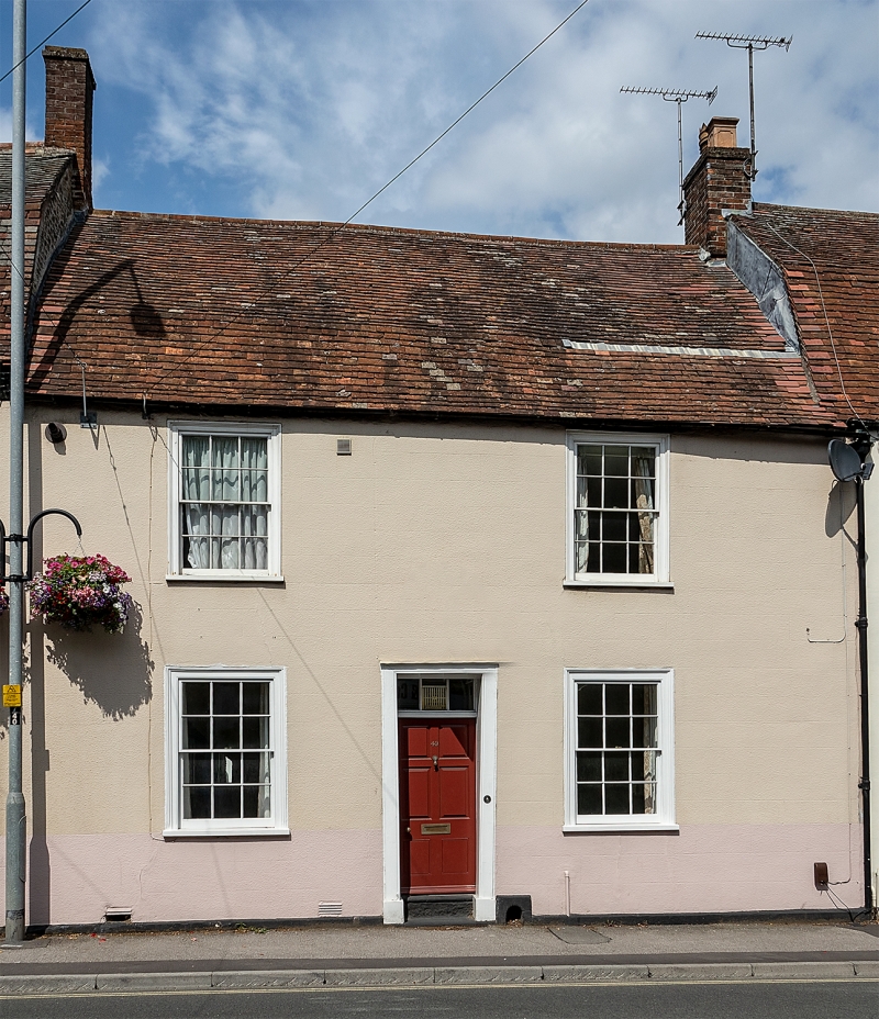
WARMINSTER SILVER STREET
1.
5411
(North Side)
No 49
ST 8745 SW 6/324
II GV
2.
Late C18/early C19. 2 storeys, slightly lower than Nos 48 and 50. Rendered.
Old tile roof with slight mansard. 2 ranges of glazing bar sashes with flush
moulded frames. Central doorway with plain surround, 3 part rectangular overlight
and modern door.
Listing NGR: ST8708245147
External links are from the relevant listing authority and, where applicable, Wikidata. Wikidata IDs may be related buildings as well as this specific building. If you want to add or update a link, you will need to do so by editing the Wikidata entry.


Other nearby listed buildings
