Approximate Location Map
Large Map »
Latitude: 52.0362 / 52°2'10"N
Longitude: 0.7277 / 0°43'39"E
OS Eastings: 587188
OS Northings: 241048
OS Grid: TL871410
Mapcode National: GBR QHJ.BSR
Mapcode Global: VHKF9.K2JV
Plus Code: 9F422PPH+F3
Entry Name: 49, Friars Street
Listing Date: 26 October 1971
Grade: II
Source: Historic England
Source ID: 1037500
English Heritage Legacy ID: 276002
ID on this website: 101037500
Location: Sudbury, Babergh, Suffolk, CO10
County: Suffolk
District: Babergh
Civil Parish: Sudbury
Built-Up Area: Sudbury
Traditional County: Suffolk
Lieutenancy Area (Ceremonial County): Suffolk
Church of England Parish: Sudbury St Gregory with Chilton St Peter
Church of England Diocese: St.Edmundsbury and Ipswich
Tagged with: Building
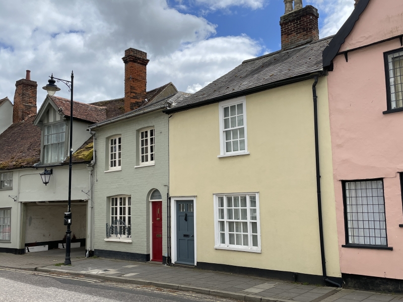
1. FRIARS STREET
1692
(South East Side)
No 49
TL 8741 3/163
II GV
2.
Probably C18. 2 storeys 1 window. Stucco, lined and painted. Slate roof.
Near-flush-frame sash windows with thick glazing bars. Wide b-panel entrance
door. Arched doorway and windows.
Nos 27 to 31 (odd), The Friars, Nos 33 to 45 (odd), Nos 49 and 51 form a
group.
Listing NGR: TL8718841048
External links are from the relevant listing authority and, where applicable, Wikidata. Wikidata IDs may be related buildings as well as this specific building. If you want to add or update a link, you will need to do so by editing the Wikidata entry.


Other nearby listed buildings
