Approximate Location Map
Large Map »
Latitude: 52.0408 / 52°2'26"N
Longitude: 0.7259 / 0°43'33"E
OS Eastings: 587048
OS Northings: 241549
OS Grid: TL870415
Mapcode National: GBR QHJ.49Z
Mapcode Global: VHKF3.JYLX
Plus Code: 9F422PRG+89
Entry Name: Churchyard Walls
Listing Date: 26 October 1971
Grade: II
Source: Historic England
Source ID: 1037549
English Heritage Legacy ID: 275917
ID on this website: 101037549
Location: Sudbury, Babergh, Suffolk, CO10
County: Suffolk
District: Babergh
Civil Parish: Sudbury
Built-Up Area: Sudbury
Traditional County: Suffolk
Lieutenancy Area (Ceremonial County): Suffolk
Church of England Parish: Sudbury St Gregory with Chilton St Peter
Church of England Diocese: St.Edmundsbury and Ipswich
Tagged with: Churchyard wall
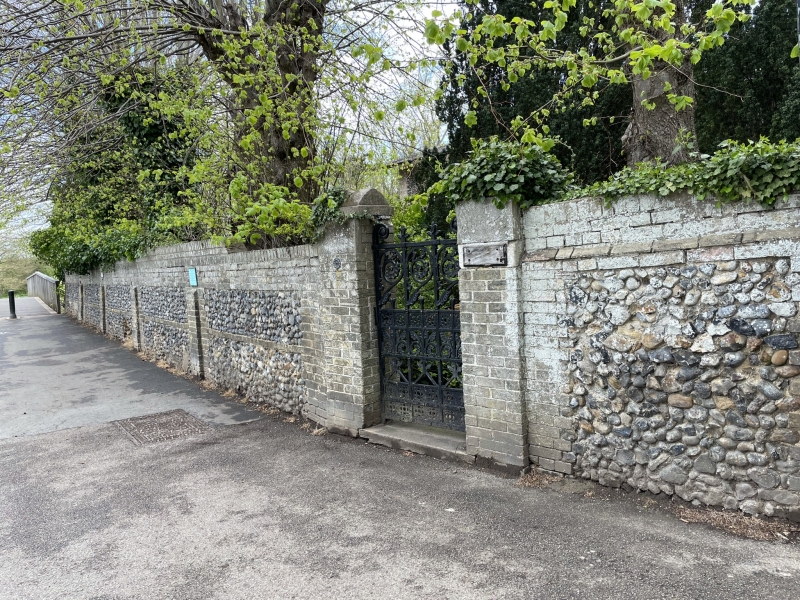
1. Churchyard Walls
1692
TL 8641 3/3A
TL 8741 3/3A
II
2.
Medieval with restorations, brick and stone churchyard walls, part with
Gothic cope. NMR photos.
Listing NGR: TL8704841549
External links are from the relevant listing authority and, where applicable, Wikidata. Wikidata IDs may be related buildings as well as this specific building. If you want to add or update a link, you will need to do so by editing the Wikidata entry.


Other nearby listed buildings
