Approximate Location Map
Large Map »
Latitude: 52.6287 / 52°37'43"N
Longitude: -2.4839 / 2°29'1"W
OS Eastings: 367344
OS Northings: 303546
OS Grid: SJ673035
Mapcode National: GBR BW.7H72
Mapcode Global: WH9DG.T6D3
Plus Code: 9C4VJGH8+FC
Entry Name: 24, St Lukes Road
Listing Date: 8 April 1983
Grade: II
Source: Historic England
Source ID: 1038662
English Heritage Legacy ID: 362207
ID on this website: 101038662
Location: Ironbridge, Telford and Wrekin, Shropshire, TF8
County: Telford and Wrekin
Civil Parish: The Gorge
Built-Up Area: Telford
Traditional County: Shropshire
Lieutenancy Area (Ceremonial County): Shropshire
Church of England Parish: Ironbridge
Church of England Diocese: Hereford
Tagged with: Building
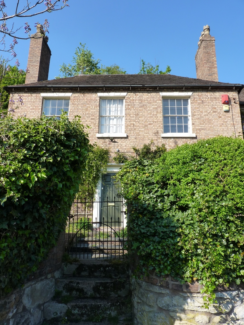
IRONBRIDGE ST LUKES ROAD
1.
5362 No 24
SJ 6703 NW 15/351
II GV
2.
Early/mid C19 buff brick house. Plain tile hipped roof with brick dentil eaves
course. Two storeys. Three bays. Sashes with glazing bars, voussoired lintels
with keyblocks. Central door, the doorcase is missing. Brick end chimney stacks.
Included for group value.
Listing NGR: SJ6734403546
External links are from the relevant listing authority and, where applicable, Wikidata. Wikidata IDs may be related buildings as well as this specific building. If you want to add or update a link, you will need to do so by editing the Wikidata entry.


Other nearby listed buildings
