Approximate Location Map
Large Map »
Latitude: 52.236 / 52°14'9"N
Longitude: -0.8975 / 0°53'50"W
OS Eastings: 475388
OS Northings: 260327
OS Grid: SP753603
Mapcode National: GBR BW8.V7T
Mapcode Global: VHDS5.D2D7
Plus Code: 9C4X64P3+92
Entry Name: The Saddlers Arms
Listing Date: 22 January 1976
Grade: II
Source: Historic England
Source ID: 1039711
English Heritage Legacy ID: 231961
ID on this website: 101039711
Location: Northampton, West Northamptonshire, NN1
County: West Northamptonshire
Electoral Ward/Division: Castle
Parish: Northampton
Built-Up Area: Northampton
Traditional County: Northamptonshire
Lieutenancy Area (Ceremonial County): Northamptonshire
Church of England Parish: Northampton All Saints with St Katherine
Church of England Diocese: Peterborough
Tagged with: Building
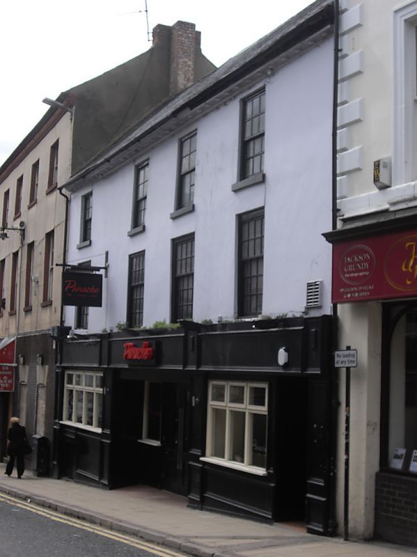
BRIDGE STREET
1.
5327
(West Side)
Nos 26 & 28
(The Saddlers Arms)
SP 7560 SW 3/242
II GV
2.
Cl8 or earlier. Stucco, tiled roof with modillioned cornice. 3 storeys, 4 sash
windows with glazing bars. Altered ground floor.
Nos 32A, 32B & 16 to 32 (even) form a group.
Listing NGR: SP7538860326
External links are from the relevant listing authority and, where applicable, Wikidata. Wikidata IDs may be related buildings as well as this specific building. If you want to add or update a link, you will need to do so by editing the Wikidata entry.


Other nearby listed buildings
