Approximate Location Map
Large Map »
Latitude: 51.382 / 51°22'55"N
Longitude: 0.358 / 0°21'28"E
OS Eastings: 564190
OS Northings: 167407
OS Grid: TQ641674
Mapcode National: GBR NNB.7BG
Mapcode Global: VHJLR.5J4F
Plus Code: 9F3299J5+Q6
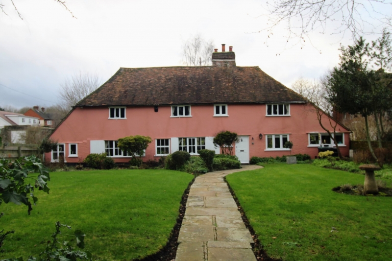
Entry Name: Mulberry House
Listing Date: 26 July 1983
Grade: II
Source: Historic England
Source ID: 1039911
English Heritage Legacy ID: 356809
ID on this website: 101039911
Location: Hook Green, Gravesham, Kent, DA13
County: Kent
District: Gravesham
Civil Parish: Meopham
Built-Up Area: Meopham
Traditional County: Kent
Lieutenancy Area (Ceremonial County): Kent
Church of England Parish: Meopham St John the Baptist
Church of England Diocese: Rochester
Tagged with: House
TQ 66 NW MEOPHAM MELLIKER LANE
4/80
Mulberry House
II
C16 brick with rendered first floor. Tiled hipped roof with pentice. Casement
windows. Moulded beams internally.
Listing NGR: TQ6419067407
External links are from the relevant listing authority and, where applicable, Wikidata. Wikidata IDs may be related buildings as well as this specific building. If you want to add or update a link, you will need to do so by editing the Wikidata entry.


Other nearby listed buildings
