Approximate Location Map
Large Map »
Latitude: 51.3836 / 51°23'1"N
Longitude: 0.3584 / 0°21'30"E
OS Eastings: 564210
OS Northings: 167593
OS Grid: TQ642675
Mapcode National: GBR NNB.7F5
Mapcode Global: VHJLR.5HB5
Plus Code: 9F3299M5+F9
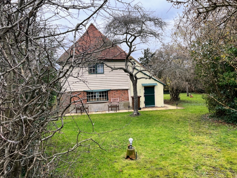
Entry Name: Waterditch
Listing Date: 26 July 1983
Grade: II
Source: Historic England
Source ID: 1039914
English Heritage Legacy ID: 356813
ID on this website: 101039914
Location: Hook Green, Gravesham, Kent, DA13
County: Kent
District: Gravesham
Civil Parish: Meopham
Built-Up Area: Meopham
Traditional County: Kent
Lieutenancy Area (Ceremonial County): Kent
Church of England Parish: Meopham St John the Baptist
Church of England Diocese: Rochester
Tagged with: Building
TQ 66 NW MEOPHAM NORWOOD LANE
4/84
Waterditch
II
C16 south end. Brick with weatherboarded first floor. Hipped tiled roof with
pentice. Remainder C19.
Listing NGR: TQ6427167583
External links are from the relevant listing authority and, where applicable, Wikidata. Wikidata IDs may be related buildings as well as this specific building. If you want to add or update a link, you will need to do so by editing the Wikidata entry.


Other nearby listed buildings
