Approximate Location Map
Large Map »
Latitude: 55.4114 / 55°24'41"N
Longitude: -1.6983 / 1°41'53"W
OS Eastings: 419198
OS Northings: 613094
OS Grid: NU191130
Mapcode National: GBR J5LV.3Z
Mapcode Global: WHC1K.W7GW
Plus Code: 9C7WC862+HM
Entry Name: Former Pant
Listing Date: 25 August 1977
Grade: II
Source: Historic England
Source ID: 1041503
English Heritage Legacy ID: 235694
ID on this website: 101041503
Location: Alnwick, Northumberland, NE66
County: Northumberland
Civil Parish: Alnwick
Built-Up Area: Alnwick
Traditional County: Northumberland
Lieutenancy Area (Ceremonial County): Northumberland
Church of England Parish: Alnwick
Church of England Diocese: Newcastle
Tagged with: Building
NU 1813
7/231
5330
DENWICK ROAD
(South-East Side)
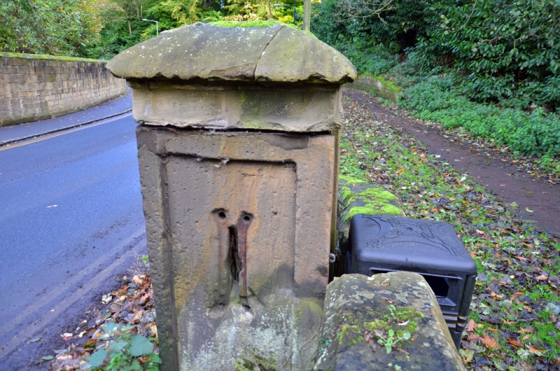
Former Pant
II
Square pillar box with. panelled sides and coved capping. Early c19 probably.
Percy Crescent in front. Rear panel missing.
Listing NGR: NU1919813094
External links are from the relevant listing authority and, where applicable, Wikidata. Wikidata IDs may be related buildings as well as this specific building. If you want to add or update a link, you will need to do so by editing the Wikidata entry.


Other nearby listed buildings
