Approximate Location Map
Large Map »
Latitude: 50.7873 / 50°47'14"N
Longitude: 0.3306 / 0°19'50"E
OS Eastings: 564376
OS Northings: 101226
OS Grid: TQ643012
Mapcode National: GBR NWG.DG3
Mapcode Global: FRA C7L0.DMS
Plus Code: 9F22Q8PJ+W6
Entry Name: Martello Tower East of Langney Priory
Listing Date: 17 May 1971
Grade: II
Source: Historic England
Source ID: 1043660
English Heritage Legacy ID: 293529
ID on this website: 101043660
Location: Eastbourne, East Sussex, BN23
County: East Sussex
District: Eastbourne
Parish: Non Civil Parish
Built-Up Area: Eastbourne
Traditional County: Sussex
Lieutenancy Area (Ceremonial County): East Sussex
Church of England Parish: Eastbourne, St Richard Langney
Church of England Diocese: Chichester
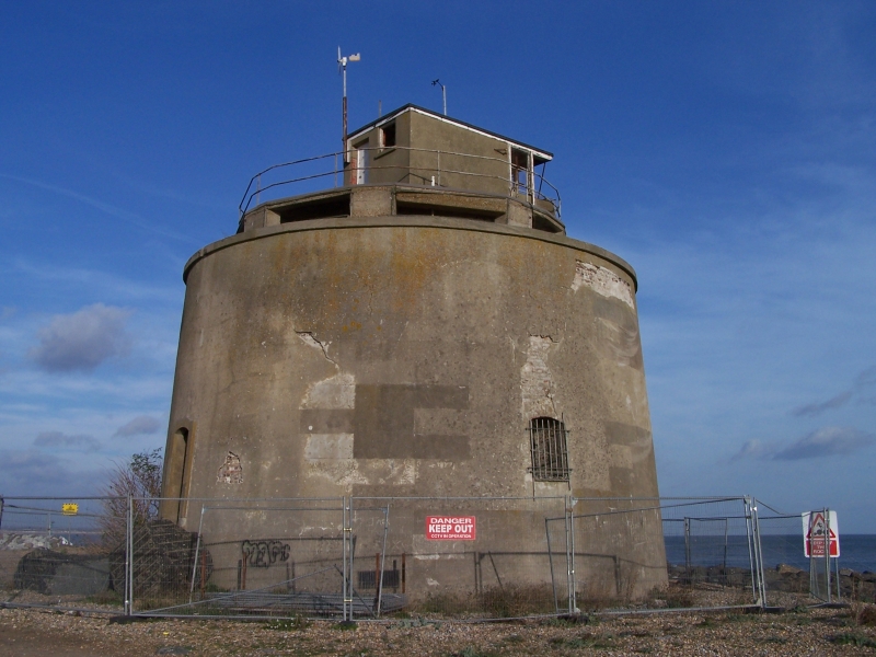
Martello Tower North
1. of Langney Point
1065
TQ 60 SW 13/35
II
2.
Used for defence purposes during the 1939/45 war. Flat gun emplacements
were constructed on the roof.
Listing NGR: TQ6437601226
External links are from the relevant listing authority and, where applicable, Wikidata. Wikidata IDs may be related buildings as well as this specific building. If you want to add or update a link, you will need to do so by editing the Wikidata entry.


Other nearby listed buildings
