Approximate Location Map
Large Map »
Latitude: 50.9208 / 50°55'14"N
Longitude: -0.1147 / 0°6'52"W
OS Eastings: 532612
OS Northings: 115177
OS Grid: TQ326151
Mapcode National: GBR KPB.1V9
Mapcode Global: FRA B6NN.TC4
Plus Code: 9C2XWVCP+84
Entry Name: Tudor Close
Listing Date: 20 August 1965
Grade: II
Source: Historic England
Source ID: 1043960
English Heritage Legacy ID: 292840
ID on this website: 101043960
Location: Ditchling, Lewes, East Sussex, BN6
County: East Sussex
District: Lewes
Civil Parish: Ditchling
Built-Up Area: Ditchling
Traditional County: Sussex
Lieutenancy Area (Ceremonial County): East Sussex
Church of England Parish: Ditchling, Streat and Westmeston
Church of England Diocese: Chichester
Tagged with: Building
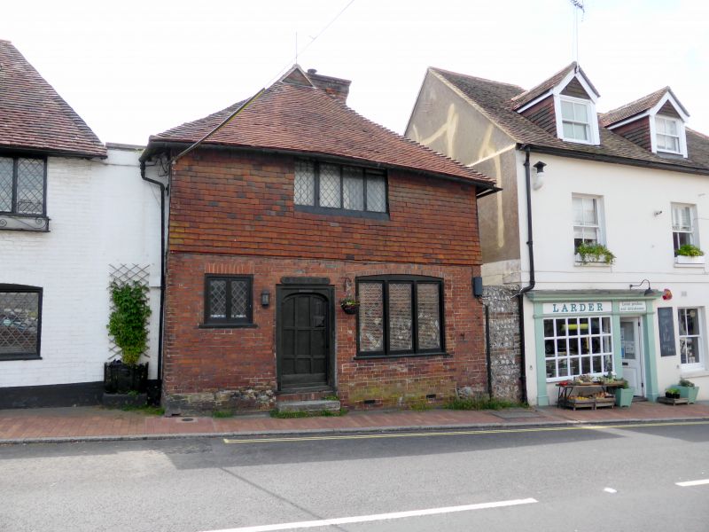
DITCHLING LEWES ROAD
1.
5206
No 2
(Tudor Close)
TQ 3215 20/289 20.8.65.
II
2.
C15 timber-framed building refronted with red brick on ground floor and tile-
hung above, but the timbering with close-studding and plaster infilling exposed
in east wall. Tiled roof. Casement windows. Old wooden door of 9 panels.
Two storeys. Two windows.
Listing NGR: TQ3261415176
External links are from the relevant listing authority and, where applicable, Wikidata. Wikidata IDs may be related buildings as well as this specific building. If you want to add or update a link, you will need to do so by editing the Wikidata entry.


Other nearby listed buildings
