Approximate Location Map
Large Map »
Latitude: 50.9175 / 50°55'2"N
Longitude: 0.4843 / 0°29'3"E
OS Eastings: 574722
OS Northings: 116054
OS Grid: TQ747160
Mapcode National: GBR PWF.H7R
Mapcode Global: FRA C6XP.0JC
Plus Code: 9F22WF8M+XP
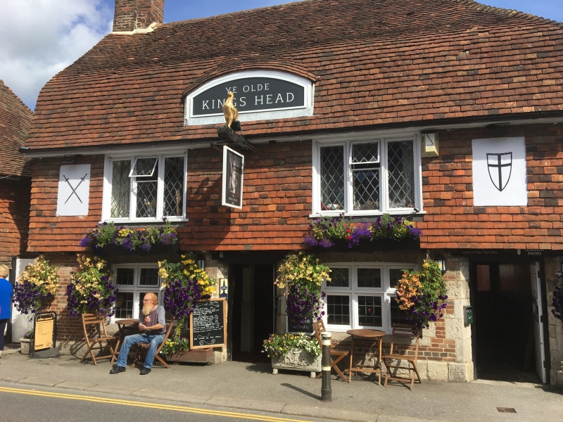
Entry Name: The King's Head Inn
Listing Date: 13 May 1987
Grade: II
Source: Historic England
Source ID: 1044168
English Heritage Legacy ID: 292216
ID on this website: 101044168
Location: Battle, Rother, East Sussex, TN33
County: East Sussex
District: Rother
Civil Parish: Battle
Built-Up Area: Battle
Traditional County: Sussex
Lieutenancy Area (Ceremonial County): East Sussex
Church of England Parish: Battle St Mary the Virgin
Church of England Diocese: Chichester
Tagged with: Inn
TQ 7416-7516 BATTLE MOUNT STREET
(east side)
40/33 The King's Head Inn
GV II
C17 or earlier timber-framed building, modernised and refronted with red brick
stone and tile-hung. Tiled roof. Casement windows. Two storeys and attic.
Two windows. One dormer.
Listing NGR: TQ7473416049
External links are from the relevant listing authority and, where applicable, Wikidata. Wikidata IDs may be related buildings as well as this specific building. If you want to add or update a link, you will need to do so by editing the Wikidata entry.


Other nearby listed buildings
