Approximate Location Map
Large Map »
Latitude: 54.9672 / 54°58'1"N
Longitude: -1.8709 / 1°52'15"W
OS Eastings: 408362
OS Northings: 563626
OS Grid: NZ083636
Mapcode National: GBR HCC0.R6
Mapcode Global: WHC3M.7DBX
Plus Code: 9C6WX48H+VJ
Entry Name: Footbridge
Listing Date: 7 March 1985
Grade: II
Source: Historic England
Source ID: 1044945
English Heritage Legacy ID: 239476
Also known as: Footbridge, West Road
ID on this website: 101044945
Location: Ovingham, Northumberland, NE42
County: Northumberland
Civil Parish: Ovingham
Built-Up Area: Ovingham
Traditional County: Northumberland
Lieutenancy Area (Ceremonial County): Northumberland
Church of England Parish: Ovingham
Church of England Diocese: Newcastle
Tagged with: Footbridge Packhorse bridge
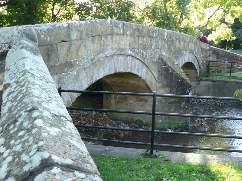
NZ 0863 - 0963 OVINGHAM WEST ROAD
22/121 Footbridge
II
Footbridge. C18. Dressed stone. Narrow bridge of 2 segmental arches with arch bands.
Triangular cutwater between. Plain parapet with chamfered top. Approach walls splay
outwards and have ridged coping.
Listing NGR: NZ0836063626
External links are from the relevant listing authority and, where applicable, Wikidata. Wikidata IDs may be related buildings as well as this specific building. If you want to add or update a link, you will need to do so by editing the Wikidata entry.


Other nearby listed buildings
