Approximate Location Map
Large Map »
Latitude: 53.0924 / 53°5'32"N
Longitude: -0.8426 / 0°50'33"W
OS Eastings: 477602
OS Northings: 355652
OS Grid: SK776556
Mapcode National: GBR BK2.3RR
Mapcode Global: WHFHH.1J0M
Plus Code: 9C5X35R4+XW
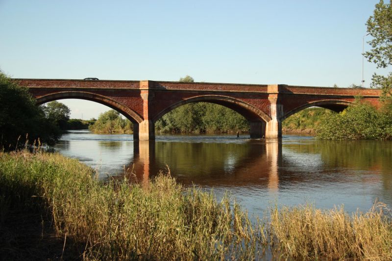
Entry Name: Kelham Bridge
Listing Date: 7 August 1951
Grade: II
Source: Historic England
Source ID: 1045988
English Heritage Legacy ID: 242765
ID on this website: 101045988
Location: Kelham, Newark and Sherwood, Nottinghamshire, NG23
County: Nottinghamshire
District: Newark and Sherwood
Civil Parish: Kelham
Traditional County: Nottinghamshire
Lieutenancy Area (Ceremonial County): Nottinghamshire
Church of England Parish: Kelham
Church of England Diocese: Southwell and Nottingham
Tagged with: Road bridge
SK 75 NE KELHAM NEWARK ROAD
7/6 1 Kelham Bridge
7-8-51
II
Road bridge. 1857. Brick with ashlar dressings. 5 segmental
arches of various sizes. 4 canted ashlar-faced piers. Chamfered
ashlar soffits and hood moulds. Chamfered string course.
Corbelled ashlar pedestrian refuges. Plain ashlar coping, partly
renewed.
Listing NGR: SK7760255652
External links are from the relevant listing authority and, where applicable, Wikidata. Wikidata IDs may be related buildings as well as this specific building. If you want to add or update a link, you will need to do so by editing the Wikidata entry.


Other nearby listed buildings
