Approximate Location Map
Large Map »
Latitude: 51.756 / 51°45'21"N
Longitude: -1.2553 / 1°15'19"W
OS Eastings: 451499
OS Northings: 206627
OS Grid: SP514066
Mapcode National: GBR 8YY.TQF
Mapcode Global: VHCXV.6476
Plus Code: 9C3WQP4V+9V
Entry Name: Trinity College, Gate Piers and Grille
Listing Date: 12 January 1954
Grade: II*
Source: Historic England
Source ID: 1046630
English Heritage Legacy ID: 245175
ID on this website: 101046630
Location: Oxford, Oxfordshire, OX1
County: Oxfordshire
District: Oxford
Town: Oxford
Electoral Ward/Division: Holywell
Parish: Non Civil Parish
Built-Up Area: Oxford
Traditional County: Oxfordshire
Lieutenancy Area (Ceremonial County): Oxfordshire
Church of England Parish: Oxford St Mary Magdalen
Church of England Diocese: Oxford
Tagged with: Architectural structure
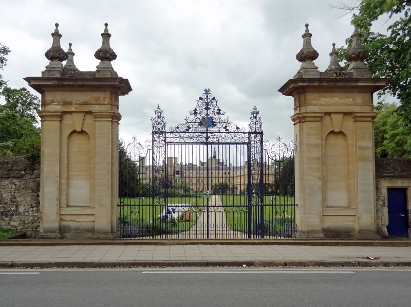
TRINITY COLLEGE
1.
1485
Gate-piers and grille
on Parks Road
SP 5106 NW 5/139D 12.1.54.
II*
2.
In the East wall, on Parks Road, are stone gate piers and a grille, 1713,
possibly by William Townesend.
Listing NGR: SP5139506461
External links are from the relevant listing authority and, where applicable, Wikidata. Wikidata IDs may be related buildings as well as this specific building. If you want to add or update a link, you will need to do so by editing the Wikidata entry.


Other nearby listed buildings
