Approximate Location Map
Large Map »
Latitude: 51.7561 / 51°45'22"N
Longitude: -1.2554 / 1°15'19"W
OS Eastings: 451490
OS Northings: 206646
OS Grid: SP514066
Mapcode National: GBR 8YY.TP2
Mapcode Global: VHCXV.6452
Plus Code: 9C3WQP4V+FR
Entry Name: Trinity College, east boundary wall on Parks Road to north gateway
Listing Date: 28 June 1972
Grade: II
Source: Historic England
Source ID: 1046631
English Heritage Legacy ID: 245176
ID on this website: 101046631
Location: Oxford, Oxfordshire, OX1
County: Oxfordshire
District: Oxford
Electoral Ward/Division: Holywell
Parish: Non Civil Parish
Built-Up Area: Oxford
Traditional County: Oxfordshire
Lieutenancy Area (Ceremonial County): Oxfordshire
Church of England Parish: Oxford St Mary Magdalen
Church of England Diocese: Oxford
Tagged with: Building
This list entry was subject to a Minor Amendment on 22 April 2021 to reformat the text to current standards
SP 5106 NW
5/139V
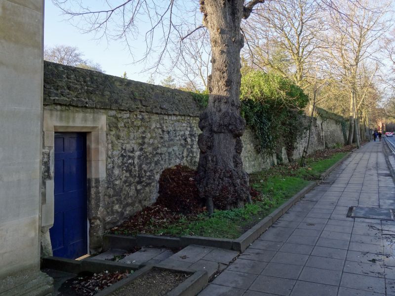
TRINITY COLLEGE
East boundary wall on Parks Road to north gateway
II
C18 or earlier. Rubble wall.
Listing NGR: SP5149006646
External links are from the relevant listing authority and, where applicable, Wikidata. Wikidata IDs may be related buildings as well as this specific building. If you want to add or update a link, you will need to do so by editing the Wikidata entry.


Other nearby listed buildings
