Approximate Location Map
Large Map »
Latitude: 51.7526 / 51°45'9"N
Longitude: -1.2544 / 1°15'15"W
OS Eastings: 451564
OS Northings: 206249
OS Grid: SP515062
Mapcode National: GBR 8Z4.1P8
Mapcode Global: VHCXV.66PT
Plus Code: 9C3WQP3W+26
Entry Name: Brasenose College, East Range and Eastern Part of South Range, Third Quadrangle
Listing Date: 29 January 1968
Grade: II
Source: Historic England
Source ID: 1046735
English Heritage Legacy ID: 244867
ID on this website: 101046735
Location: Oxford, Oxfordshire, OX1
County: Oxfordshire
District: Oxford
Electoral Ward/Division: Holywell
Parish: Non Civil Parish
Built-Up Area: Oxford
Traditional County: Oxfordshire
Lieutenancy Area (Ceremonial County): Oxfordshire
Church of England Parish: Oxford St Mary the Virgin with St Cross with St Peter-in-the-East,
Church of England Diocese: Oxford
Tagged with: Building
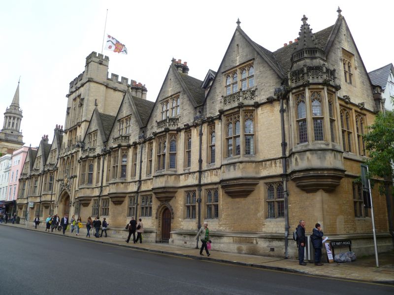
BRASENOSE COLLEGE
1.
1485
Third Quadrangle
East range and Eastern part
of South range
SP 5106 SE 9/319J 29.1.68.
II
2.
1887-9. As in west range (qv).
Listing NGR: SP5156406249
External links are from the relevant listing authority and, where applicable, Wikidata. Wikidata IDs may be related buildings as well as this specific building. If you want to add or update a link, you will need to do so by editing the Wikidata entry.


Other nearby listed buildings
