Approximate Location Map
Large Map »
Latitude: 52.062 / 52°3'43"N
Longitude: -1.3338 / 1°20'1"W
OS Eastings: 445770
OS Northings: 240612
OS Grid: SP457406
Mapcode National: GBR 7ST.RL5
Mapcode Global: VHCW7.TFRM
Plus Code: 9C4W3M68+RF
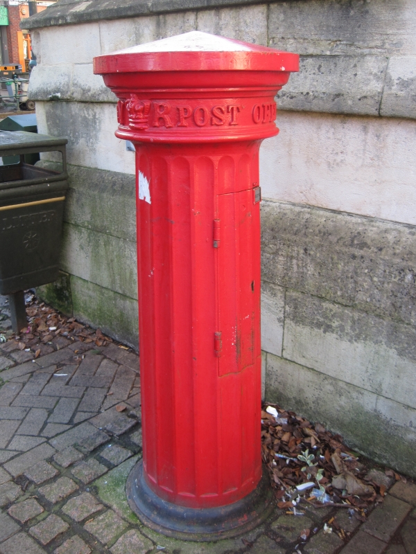
Entry Name: Pillar Box Approximately 1 Metre East of Wall in Front of Town Hall
Listing Date: 14 February 1986
Grade: II
Source: Historic England
Source ID: 1046956
English Heritage Legacy ID: 244302
ID on this website: 101046956
Location: Banbury, Cherwell, Oxfordshire, OX16
County: Oxfordshire
District: Cherwell
Civil Parish: Banbury
Built-Up Area: Banbury
Traditional County: Oxfordshire
Lieutenancy Area (Ceremonial County): Oxfordshire
Church of England Parish: Banbury St Mary
Church of England Diocese: Oxford
Tagged with: Pillar box
BANBURY BRIDGE STREET
SP4540NE
7/15 Pillar Box approx. lm. E of
wall in front of Town Hall
GV II
Pillar box, c.1856. Metal painted red. Circular with fluted sides and conical
top. Included for group value.
Listing NGR: SP4577040612
External links are from the relevant listing authority and, where applicable, Wikidata. Wikidata IDs may be related buildings as well as this specific building. If you want to add or update a link, you will need to do so by editing the Wikidata entry.


Other nearby listed buildings
