Approximate Location Map
Large Map »
Latitude: 51.7842 / 51°47'3"N
Longitude: -1.2831 / 1°16'59"W
OS Eastings: 449547
OS Northings: 209748
OS Grid: SP495097
Mapcode National: GBR 7XD.0FP
Mapcode Global: VHCXM.QF02
Plus Code: 9C3WQPM8+MP
Entry Name: 41 Wolvercote Green
Listing Date: 28 June 1972
Grade: II
Source: Historic England
Source ID: 1047065
English Heritage Legacy ID: 245939
ID on this website: 101047065
Location: Wolvercote, Oxford, Oxfordshire, OX2
County: Oxfordshire
District: Oxford
Electoral Ward/Division: Wolvercote
Parish: Non Civil Parish
Built-Up Area: Oxford
Traditional County: Oxfordshire
Lieutenancy Area (Ceremonial County): Oxfordshire
Church of England Parish: Wolvercote
Church of England Diocese: Oxford
Tagged with: Building
SP 4909
17/866
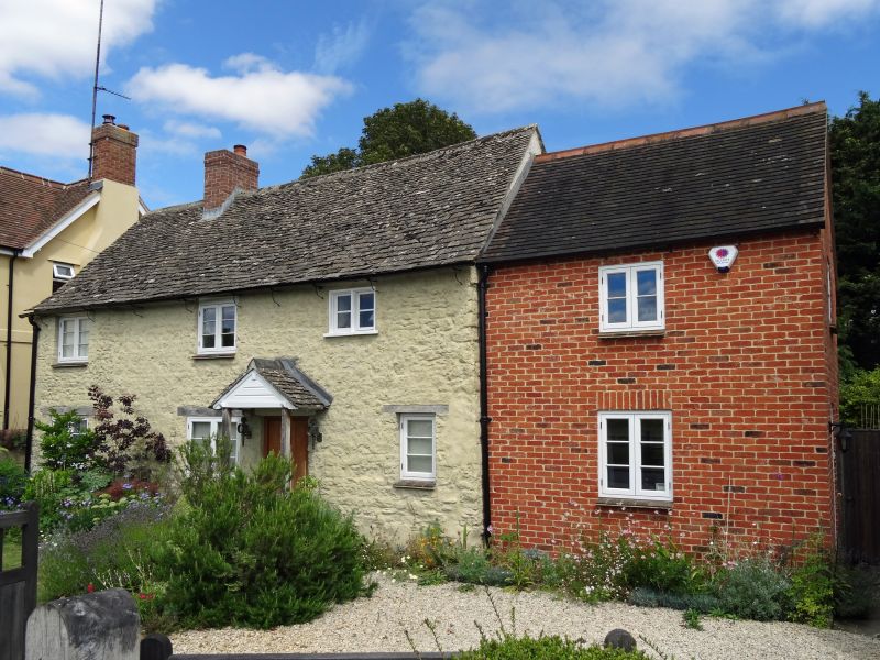
WOLVERCOTE GREEN
No 41
II
C18. Rendered rubble, white brick gable end. Two storeys, three windows, C19 casements. C19 gabled porch. Stone slate roof, red brick central stack with moulded cap.
Listing NGR: SP4954709748
External links are from the relevant listing authority and, where applicable, Wikidata. Wikidata IDs may be related buildings as well as this specific building. If you want to add or update a link, you will need to do so by editing the Wikidata entry.


Other nearby listed buildings
