Approximate Location Map
Large Map »
Latitude: 51.7559 / 51°45'21"N
Longitude: -1.2484 / 1°14'54"W
OS Eastings: 451977
OS Northings: 206618
OS Grid: SP519066
Mapcode National: GBR 8YY.WQH
Mapcode Global: VHCXV.94W9
Plus Code: 9C3WQQ42+8M
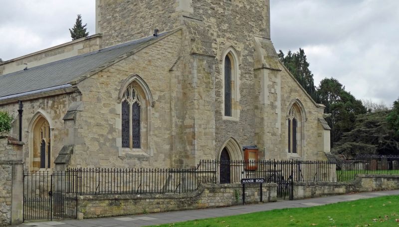
Entry Name: Churchyard Wall of the Church of St Cross
Listing Date: 28 June 1972
Grade: II
Source: Historic England
Source ID: 1047131
English Heritage Legacy ID: 245807
ID on this website: 101047131
Location: St Cross Church, Oxford, Oxfordshire, OX1
County: Oxfordshire
District: Oxford
Electoral Ward/Division: Holywell
Parish: Non Civil Parish
Built-Up Area: Oxford
Traditional County: Oxfordshire
Lieutenancy Area (Ceremonial County): Oxfordshire
Church of England Parish: Oxford St Mary the Virgin with St Cross with St Peter-in-the-East,
Church of England Diocese: Oxford
Tagged with: Churchyard wall
ST CROSS ROAD
1.
1485
(East Side)
Churchyard Wall of
the Church of St Cross
SP 5106 NE 6/120A
SP 50 NW 24/120A
II
2.
Cl9. Rubble plinth wall with cast-iron railings and 2 pairs of gates.
Listing NGR: SP5197706618
External links are from the relevant listing authority and, where applicable, Wikidata. Wikidata IDs may be related buildings as well as this specific building. If you want to add or update a link, you will need to do so by editing the Wikidata entry.


Other nearby listed buildings
