Approximate Location Map
Large Map »
Latitude: 51.6707 / 51°40'14"N
Longitude: -1.2838 / 1°17'1"W
OS Eastings: 449625
OS Northings: 197118
OS Grid: SU496971
Mapcode National: GBR 7YR.67R
Mapcode Global: VHCY6.P8NM
Plus Code: 9C3WMPC8+7F
Entry Name: 8, Bath Street
Listing Date: 19 January 1951
Grade: II
Source: Historic England
Source ID: 1048922
English Heritage Legacy ID: 250292
ID on this website: 101048922
Location: Abingdon-on-Thames, Vale of White Horse, Oxfordshire, OX14
County: Oxfordshire
District: Vale of White Horse
Civil Parish: Abingdon on Thames
Built-Up Area: Abingdon
Traditional County: Berkshire
Lieutenancy Area (Ceremonial County): Oxfordshire
Church of England Parish: Abingdon-on-Thames
Church of England Diocese: Oxford
Tagged with: Building
1.
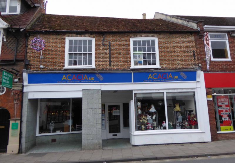
752 BATH STREET
(West Side)
SU 4997 1/37 19.1.51 No 8
II
2.
Late C18. Chequered brick. Tile roof Two storeys. Two windows,
flush frames, segmental arches, double hung sash with glazing bars.
Modern ground floor shop front.
Listing NGR: SU4962097118
External links are from the relevant listing authority and, where applicable, Wikidata. Wikidata IDs may be related buildings as well as this specific building. If you want to add or update a link, you will need to do so by editing the Wikidata entry.


Other nearby listed buildings
