Approximate Location Map
Large Map »
Latitude: 52.6314 / 52°37'53"N
Longitude: 1.3042 / 1°18'15"E
OS Eastings: 623699
OS Northings: 308864
OS Grid: TG236088
Mapcode National: GBR WBN.QM
Mapcode Global: WHMTN.04B1
Plus Code: 9F43J8J3+HM
Entry Name: 39, the Close
Listing Date: 5 June 1972
Grade: II*
Source: Historic England
Source ID: 1051305
English Heritage Legacy ID: 228955
ID on this website: 101051305
Location: The Close, Norwich, Norfolk, NR1
County: Norfolk
District: Norwich
Electoral Ward/Division: Thorpe Hamlet
Parish: Non Civil Parish
Built-Up Area: Norwich
Traditional County: Norfolk
Lieutenancy Area (Ceremonial County): Norfolk
Tagged with: Building
TG 2308 NE THE CLOSE
17/206
5.6.72 No. 39
GV II*
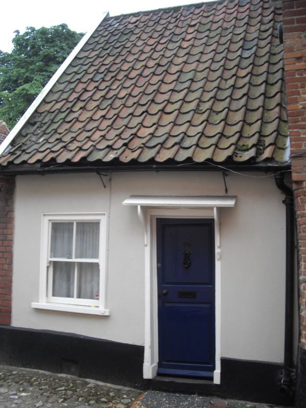
House. C17 Rendered brick and pantile roof. Single storey plus attic.
Single bay. Door in simple frame with hood on brackets. Sash window
to left with plain surround.
Listing NGR: TG2369908864
External links are from the relevant listing authority and, where applicable, Wikidata. Wikidata IDs may be related buildings as well as this specific building. If you want to add or update a link, you will need to do so by editing the Wikidata entry.


Other nearby listed buildings
