Approximate Location Map
Large Map »
Latitude: 51.7846 / 51°47'4"N
Longitude: -1.4756 / 1°28'32"W
OS Eastings: 436269
OS Northings: 209675
OS Grid: SP362096
Mapcode National: GBR 6VS.5QB
Mapcode Global: VHC02.CDRS
Plus Code: 9C3WQGMF+RQ
Entry Name: Wall Approximately 59 Metres North East East of Manor Farmhouse
Listing Date: 3 March 1988
Grade: II
Source: Historic England
Source ID: 1053062
English Heritage Legacy ID: 252636
ID on this website: 101053062
Location: Cogges, West Oxfordshire, OX28
County: Oxfordshire
District: West Oxfordshire
Civil Parish: Witney
Built-Up Area: Witney
Traditional County: Oxfordshire
Lieutenancy Area (Ceremonial County): Oxfordshire
Church of England Parish: Cogges
Church of England Diocese: Oxford
Tagged with: Wall
WITNEY COGGES
SP3609
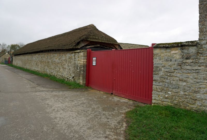
8/82 Wall approx. 58m. NEE of
Manor Farmhouse
GV II
Wall. C18. Coursed limestone rubble with ashlar coping, approx. 20 m. long,
attached to rubble wall approx. 3m. long to rear. Included for group value.
Listing NGR: SP3626709664
External links are from the relevant listing authority and, where applicable, Wikidata. Wikidata IDs may be related buildings as well as this specific building. If you want to add or update a link, you will need to do so by editing the Wikidata entry.


Other nearby listed buildings
