Approximate Location Map
Large Map »
Latitude: 52.5371 / 52°32'13"N
Longitude: -2.4208 / 2°25'14"W
OS Eastings: 371552
OS Northings: 293332
OS Grid: SO715933
Mapcode National: GBR BZ.F6Q8
Mapcode Global: VH90Z.0H1D
Plus Code: 9C4VGHPH+RM
Entry Name: 25, Northgate
Listing Date: 9 March 1970
Grade: II
Source: Historic England
Source ID: 1053943
English Heritage Legacy ID: 254489
ID on this website: 101053943
Location: High Town, Shropshire, WV16
County: Shropshire
Civil Parish: Bridgnorth
Built-Up Area: Bridgnorth
Traditional County: Shropshire
Lieutenancy Area (Ceremonial County): Shropshire
Church of England Parish: Bridgnorth
Church of England Diocese: Hereford
Tagged with: Building
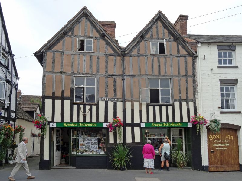
1.
1954 BRIDGNORTH
NORTHGATE
(West Side)
No 25
SO 79 SW 2/158 9.3.70.
II GV
2.
Late C16 timber frame and plaster. Post and pan; 2 storeys plus attic;
2 simple casement windows; 2 gables with plain barge-boards. Modern shop
front.
Nos 21 to 25 (consec) and North Gate form a group
Listing NGR: SO7155293332
External links are from the relevant listing authority and, where applicable, Wikidata. Wikidata IDs may be related buildings as well as this specific building. If you want to add or update a link, you will need to do so by editing the Wikidata entry.


Other nearby listed buildings
