Approximate Location Map
Large Map »
Latitude: 52.5346 / 52°32'4"N
Longitude: -2.4193 / 2°25'9"W
OS Eastings: 371656
OS Northings: 293052
OS Grid: SO716930
Mapcode National: GBR BZ.FF3F
Mapcode Global: VH90Z.0KWB
Plus Code: 9C4VGHMJ+R7
Entry Name: Moorgate House
Listing Date: 1 February 1974
Grade: II
Source: Historic England
Source ID: 1053944
English Heritage Legacy ID: 254491
ID on this website: 101053944
Location: Bridgnorth, Shropshire, WV16
County: Shropshire
Civil Parish: Bridgnorth
Built-Up Area: Bridgnorth
Traditional County: Shropshire
Lieutenancy Area (Ceremonial County): Shropshire
Church of England Parish: Bridgnorth
Church of England Diocese: Hereford
Tagged with: Building
This List entry was subject to a Minor Amendment on 01/05/2018
SO 79 SW
2/163
BRIDGNORTH
POSTERN GATE,
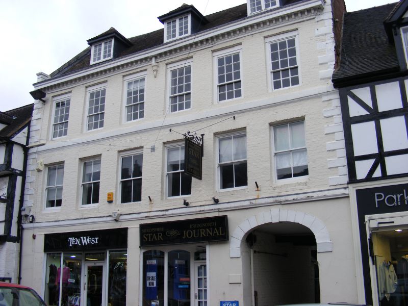
Moorgate House
(Formerly listed as Premises occupied by the Shropshire Star)
II
C17. Plastered timber framing; two storeys; three gables; modern windows and shop fronts.
Listing NGR: SO7165693052
External links are from the relevant listing authority and, where applicable, Wikidata. Wikidata IDs may be related buildings as well as this specific building. If you want to add or update a link, you will need to do so by editing the Wikidata entry.


Other nearby listed buildings
