Approximate Location Map
Large Map »
Latitude: 52.7243 / 52°43'27"N
Longitude: -2.4202 / 2°25'12"W
OS Eastings: 371714
OS Northings: 314153
OS Grid: SJ717141
Mapcode National: GBR BZ.1DWQ
Mapcode Global: WH9CX.SSPC
Plus Code: 9C4VPHFH+PW
Entry Name: Muxton Manor
Listing Date: 8 April 1983
Grade: II
Source: Historic England
Source ID: 1054177
English Heritage Legacy ID: 362043
ID on this website: 101054177
Location: Muxton, Telford and Wrekin, Shropshire, TF2
County: Telford and Wrekin
Civil Parish: Donnington and Muxton
Built-Up Area: Telford
Traditional County: Shropshire
Lieutenancy Area (Ceremonial County): Shropshire
Church of England Parish: Muxton St John the Evangelist
Church of England Diocese: Lichfield
Tagged with: Manor house
DONNINGTON MUXTON
1.
5362 Huxton Lane
No 44 (Muxton Manor)
SJ 71 SW 29/178
II GV
2.
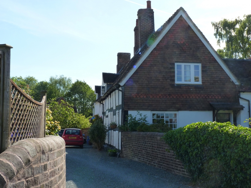
C17 timber framed farmhouse with plastered infill and extensive alterations. Steeply
pitched plain tile roof with gabled ends. North end clad in modern tiles. One storey
and attic. Casement windows and 2 small gabled dormers. Brick chimney stacks at
ridge.
Listing NGR: SJ7171414153
External links are from the relevant listing authority and, where applicable, Wikidata. Wikidata IDs may be related buildings as well as this specific building. If you want to add or update a link, you will need to do so by editing the Wikidata entry.


Other nearby listed buildings
