Approximate Location Map
Large Map »
Latitude: 52.7717 / 52°46'18"N
Longitude: -2.3821 / 2°22'55"W
OS Eastings: 374315
OS Northings: 319410
OS Grid: SJ743194
Mapcode National: GBR 7Z.YHWR
Mapcode Global: WH9CR.CLWJ
Plus Code: 9C4VQJC9+M4
Entry Name: 2A, 3, 4 and 5, Bridge Terrace
Listing Date: 28 April 1952
Grade: II
Source: Historic England
Source ID: 1054382
English Heritage Legacy ID: 255349
ID on this website: 101054382
Location: Newport, Telford and Wrekin, Shropshire, TF10
County: Telford and Wrekin
Civil Parish: Newport
Built-Up Area: Newport
Traditional County: Shropshire
Lieutenancy Area (Ceremonial County): Shropshire
Church of England Parish: Chetwynd St Michael and All Angels
Church of England Diocese: Lichfield
Tagged with: Building
SJ 7419 SW
1/3
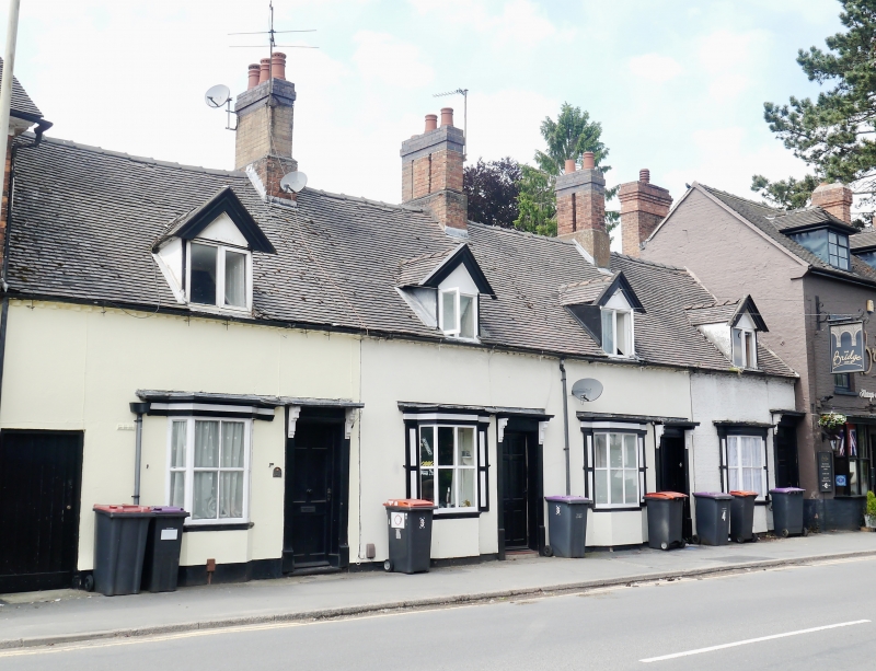
BRIDGE TERRACE
No 2A and Nos 3 to 5 (consec)
28.4.52
GV
II
An early C19 terraced range of four houses. Painted (defaced) brick; single storey plus attic; four identical moulded wood doorcases; four moulded wood bay windows (single glazing bars only); four gabled dormers; plain eaves; tiles.
Listing NGR: SJ7431519410
External links are from the relevant listing authority and, where applicable, Wikidata. Wikidata IDs may be related buildings as well as this specific building. If you want to add or update a link, you will need to do so by editing the Wikidata entry.


Other nearby listed buildings
