Approximate Location Map
Large Map »
Latitude: 51.1795 / 51°10'46"N
Longitude: -3.454 / 3°27'14"W
OS Eastings: 298464
OS Northings: 143252
OS Grid: SS984432
Mapcode National: GBR LK.5W8T
Mapcode Global: VH6GM.2MW5
Plus Code: 9C3R5GHW+QC
Entry Name: Old Frackford Bridge
Listing Date: 4 August 1983
Grade: II
Source: Historic England
Source ID: 1057597
English Heritage Legacy ID: 264748
ID on this website: 101057597
Location: Dunster, Somerset, TA24
County: Somerset
District: Somerset West and Taunton
Civil Parish: Dunster
Traditional County: Somerset
Lieutenancy Area (Ceremonial County): Somerset
Tagged with: Bridge
1.
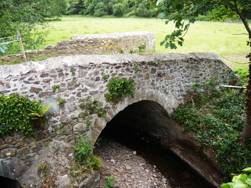
5366 DUNSTER Old Frackford Bridge
SS 9843-9943 4/119
II
2.
Dated 1768, builders William and George Rawle. Random rubble sandstone. Two semi-
circular arches, later triangular coping to parapets, partly overgrown with ivy at
time of survey. Date and names carved on slate let into east face. No longer in
use, replaced by present single span bridge in 1913.
Listing NGR: SS9846443252
External links are from the relevant listing authority and, where applicable, Wikidata. Wikidata IDs may be related buildings as well as this specific building. If you want to add or update a link, you will need to do so by editing the Wikidata entry.


Other nearby listed buildings
