Approximate Location Map
Large Map »
Latitude: 51.1799 / 51°10'47"N
Longitude: -3.447 / 3°26'49"W
OS Eastings: 298951
OS Northings: 143287
OS Grid: SS989432
Mapcode National: GBR LK.5Y9Z
Mapcode Global: VH6GM.6LKW
Plus Code: 9C3R5HH3+W5
Entry Name: Riverside
Listing Date: 22 May 1969
Grade: II
Source: Historic England
Source ID: 1057621
English Heritage Legacy ID: 264702
ID on this website: 101057621
Location: Dunster, Somerset, TA24
County: Somerset
District: Somerset West and Taunton
Civil Parish: Dunster
Built-Up Area: Dunster
Traditional County: Somerset
Lieutenancy Area (Ceremonial County): Somerset
Tagged with: Building
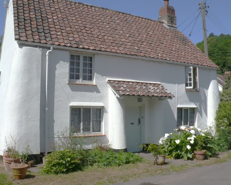
1.
5366 DUNSTER PARK STREET
No 22 (Riverside)
SS 9843-9943 4/70 22.5.69
II GV
2.
18th century with later alterations. Colourwashed rough-cast, pantiles with straight
eaves, brick and stone stacks. Two storeys. Two windows, one 3-light leaded iron
casement, others wood casements. Central plain door, later hood on brackets,
corrugated iron roof.
Listing NGR: SS9895143287
External links are from the relevant listing authority and, where applicable, Wikidata. Wikidata IDs may be related buildings as well as this specific building. If you want to add or update a link, you will need to do so by editing the Wikidata entry.


Other nearby listed buildings
