Approximate Location Map
Large Map »
Latitude: 51.5787 / 51°34'43"N
Longitude: -1.1593 / 1°9'33"W
OS Eastings: 458353
OS Northings: 186988
OS Grid: SU583869
Mapcode National: GBR 916.V13
Mapcode Global: VHCYN.VLH3
Plus Code: 9C3WHRHR+F7
Entry Name: Headstone Approximately 13 Metres South West of South Door to Nave of Church of St Mary
Listing Date: 13 January 1986
Grade: II
Source: Historic England
Source ID: 1059285
English Heritage Legacy ID: 247958
ID on this website: 101059285
Location: St Mary's Church, Cholsey, South Oxfordshire, OX10
County: Oxfordshire
District: South Oxfordshire
Civil Parish: Cholsey
Traditional County: Berkshire
Lieutenancy Area (Ceremonial County): Oxfordshire
Church of England Parish: Cholsey
Church of England Diocese: Oxford
Tagged with: Tombstone
CHOLSEY CHURCH ROAD
(West side)
SU5886
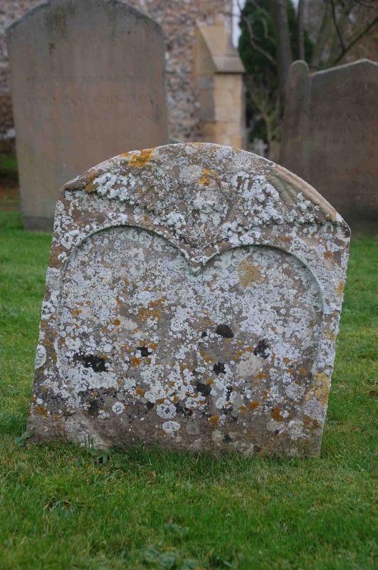
Headstone approx. 13m. SW of S
8/74
door to nave of Church of
Saint Mary
GV II
Headstone. Late C17. Stone. Heart-shaped panel with winged head above to
segmental top. Included for group value.
Listing NGR: SU5835386988
External links are from the relevant listing authority and, where applicable, Wikidata. Wikidata IDs may be related buildings as well as this specific building. If you want to add or update a link, you will need to do so by editing the Wikidata entry.


Other nearby listed buildings
