Approximate Location Map
Large Map »
Latitude: 51.5702 / 51°34'12"N
Longitude: -1.1972 / 1°11'49"W
OS Eastings: 455736
OS Northings: 186009
OS Grid: SU557860
Mapcode National: GBR 91B.J51
Mapcode Global: VHCYN.6SFN
Plus Code: 9C3WHRC3+34
Entry Name: Cob Wall Approximately 20 Metres South West of Numbers 1 and 2 Aston Street
Listing Date: 13 January 1986
Grade: II
Source: Historic England
Source ID: 1059297
English Heritage Legacy ID: 247887
ID on this website: 101059297
Location: Aston Tirrold, South Oxfordshire, OX11
County: Oxfordshire
District: South Oxfordshire
Civil Parish: Aston Tirrold
Built-Up Area: Aston Tirrold
Traditional County: Berkshire
Lieutenancy Area (Ceremonial County): Oxfordshire
Church of England Parish: Aston Tirrold
Church of England Diocese: Oxford
Tagged with: Wall
SU 5586
7/3
ASTON TIRROLD
ASTON STREET
(East side)
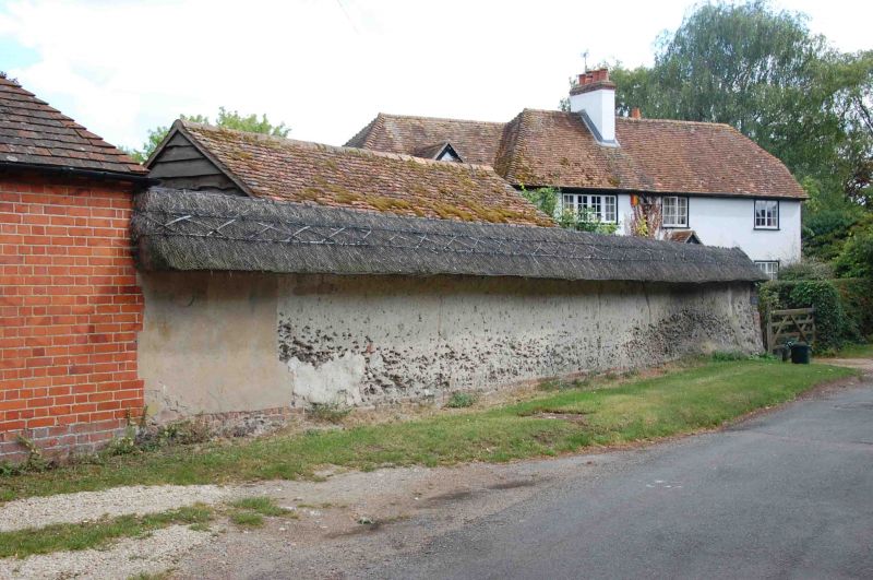
Cob wall approx. 20m. SW of Nos.l and 2 Aston Street
GV
II
Wall. C18. Cob with thatch coping.
Listing NGR: SU5573686009
External links are from the relevant listing authority and, where applicable, Wikidata. Wikidata IDs may be related buildings as well as this specific building. If you want to add or update a link, you will need to do so by editing the Wikidata entry.


Other nearby listed buildings
