Approximate Location Map
Large Map »
Latitude: 51.6454 / 51°38'43"N
Longitude: -1.0063 / 1°0'22"W
OS Eastings: 468855
OS Northings: 194537
OS Grid: SU688945
Mapcode National: GBR B1Y.Y3Y
Mapcode Global: VHDVT.HWWZ
Plus Code: 9C3WJXWV+5F
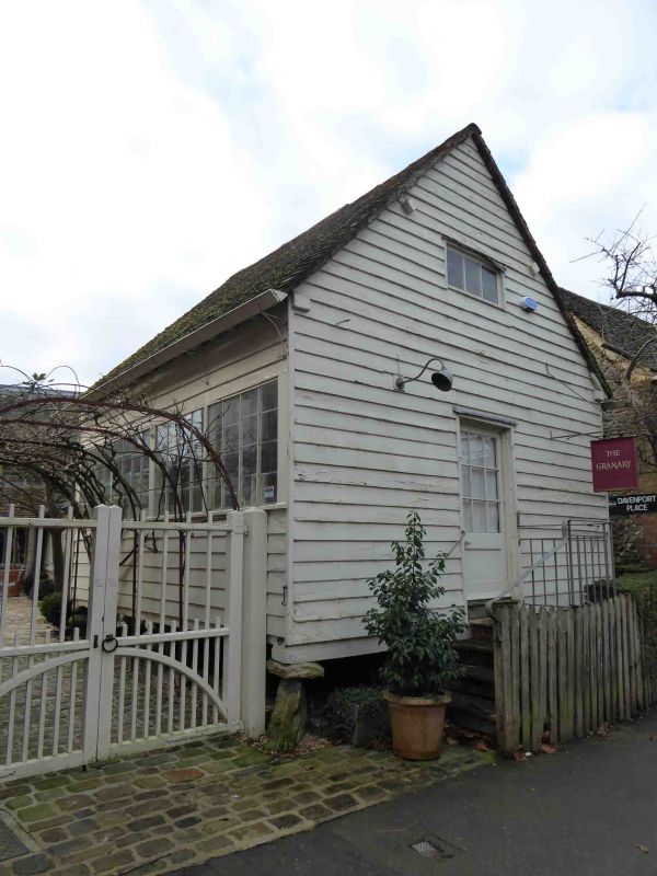
Entry Name: The Granary
Listing Date: 11 December 1985
Grade: II
Source: Historic England
Source ID: 1059412
English Heritage Legacy ID: 247665
ID on this website: 101059412
Location: Watlington, South Oxfordshire, OX49
County: Oxfordshire
District: South Oxfordshire
Civil Parish: Watlington
Built-Up Area: Watlington
Traditional County: Oxfordshire
Lieutenancy Area (Ceremonial County): Oxfordshire
Church of England Parish: Watlington
Church of England Diocese: Oxford
Tagged with: Granary
WATLINGTON HIGH STREET
SU6894 (South side)
6/193 The Granary
GV II
Granary, now shop. c.1800. Weatherboarding over timber framing on staddles.
Gabled old and C20 tile roof. C20 door and windows. Interior: pegged oak
framing, soft wood joists. Lapped elm floor boards and oak grain bins. A rare
example of a surviving High Street granary. Included for group value.
Listing NGR: SU6885894538
External links are from the relevant listing authority and, where applicable, Wikidata. Wikidata IDs may be related buildings as well as this specific building. If you want to add or update a link, you will need to do so by editing the Wikidata entry.


Other nearby listed buildings
